place

Eccles, Kent

Tonbridge and MallingVillages in Kent
BlueBellHill0011
BlueBellHill0011

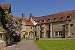
Eccles is a village in the English county of Kent, part of the parish of Aylesford and in the valley of the River Medway.

Excerpt from the Wikipedia article Eccles, Kent (License: CC BY-SA 3.0, Authors, Images).

Eccles, Kent
Bull Lane, Tonbridge and Malling Aylesford

Geographical coordinates (GPS) Address Nearby Places
placeShow on map

Wikipedia: Eccles, KentContinue reading on Wikipedia

Geographical coordinates (GPS)

Latitude Longitude
N 51.3189 ° E 0.48001 °
placeShow on map

Address

Bull Lane

Bull Lane
ME20 7HW Tonbridge and Malling, Aylesford
England, United Kingdom
mapOpen on Google Maps

BlueBellHill0011
BlueBellHill0011
Share experience

Nearby Places

Eccles Roman Villa

At Eccles in Kent the remains of a huge Roman Villa with palatial dimensions were excavated between 1962 and 1976. In the second century AD, the villa was almost 112 m long. Over 135 different rooms have been identified throughout the various periods of construction and reconstruction. The villa was abandoned in the Fourth century and much of it was removed in the Thirteenth century for the construction of Aylesford Priory. The villa lies on the east side of the Medway Valley. Roman remains were already known from the Nineteenth century on. During the course of excavation, a number of human burials of Roman date were found deposited beneath the villa floors. Further finds included fragments of Roman pottery and coins. A large post-Roman cemetery was discovered adjacent to the south-east wing of the villa. There were also some remains of a pre-Roman, Iron Age settlement. The earliest Roman villa dates from about 65 A.D. and consisted of a long row of at least 12 rooms, a porticus and probably a second story. Five of these rooms might once have contained floors with mosaics. In front of the house was a long ornamental pool. The building was of high status, as stone buildings were otherwise not so common at this early age in Roman Britain. A huge bath house was built next to it. In several rooms fragments of mosaics were found, most of them in a bad state of preservation. One of them most likely shows two gladiators.The baths were damaged by fire and around A.D. 120 a new bath house and extensions to the dwelling were built, and continued in use until A.D. 180; a third and more extensive bath suite was then erected, and the house once more remodelled by the addition of a rear corridor and new tessellations, as well as a new wing with a channelled hypocaust. A final reconstruction took place after A.D. 290, when the rear corridor was converted into a suite of rooms with hypocaust. Many rooms had tessellated floors, remains of well paintings were found.It has been suggested that the villa was first established by Adminius.The excavation record of the villa reported that much of the building stone was likely robbed in the Medieval period for construction elsewhere, for instance the 12th century St Mary's Church at Burham incorporates Roman tiles into its fabric. The results of the excavations were published in several short reports. A final excavation report is so far not yet published.

Burham
Burham

Burham is a village and civil parish in the borough of Tonbridge and Malling in Kent, England. According to the 2001 census it had a population of 1,251, decreasing to 1,195 at the 2011 Census. The village is near the Medway towns. The history of Burham can be traced to Roman times. AD43 saw the Battle of the Medway at the crossing point on the River Medway, where Burham is now, when the invading Roman legions, advancing west across Kent, were confronted by a massed army of the ancient British tribes. The Roman victory altered the course of history in Britain, and the remains of Roman buildings have been found in Burham and the neighbouring village of Eccles. There has been a Settlement in Burham since Saxon times, "ham" being the Saxon word for "settlement" — the "Bur" part of the name comes from "burgh", or borough, referring to the borough of Rochester. The name "Burham" means "the village near the borough". In the 11th century Burham belonged to Leofwine Godwinson, brother of King Harold. He was killed along with his brother at the Battle of Hastings in 1066. It is listed as having six sulings (about 240 acres) of land. There were two major farms, 15 "villeins" each farming 30 acres (120,000 m2) and 20 "borderers" each farming about 5 acres (20,000 m2). There was a church and a mill with woodland sufficient to support 20 hogs. The medieval church of St Mary is now redundant and stands on the riverbank. It is now cared for by the Churches Conservation Trust having been saved from dereliction by the Friends of Friendless Churches in the 1950s. About 1830 Burham became a "cement village" on the Medway, after the discovery of the manufacturing technique for Portland cement (so called because of its resemblance to Portland stone). By 1841 the village's population had grown to 380 and increased to a maximum of 1,725 in 1901. Today it is about 1,300.

Coffin Stone
Coffin Stone

The Coffin Stone, also known as the Coffin and the Table Stone, is a large sarsen stone at the foot of Blue Bell Hill near Aylesford in the south-eastern English county of Kent. Now lying horizontally, the stone probably once stood upright nearby. Various archaeologists have argued that the stone was part of a now-destroyed chambered long barrow constructed in the fourth millennium BCE, during Britain's Early Neolithic period. If a chambered long barrow did indeed previously exist on the site, it would have been built by pastoralist communities shortly after the introduction of agriculture to Britain from continental Europe. Long-barrow building was an architectural tradition widespread across Neolithic Europe. It consisted of various localized regional variants; one of these was in the vicinity of the River Medway, examples of which are now known as the Medway Megaliths. The Coffin Stone lies on the eastern side of the river, not far from the chambered long barrows of Little Kit's Coty House, Kit's Coty House, and the (now destroyed) Smythe's Megalith. Three other examples, the Coldrum Long Barrow, Addington Long Barrow, and Chestnuts Long Barrow, remain on the western side of the river. The Coffin Stone is a rectangular slab lying flat that measures 4.42 metres (14 ft 6 in) in length, 2.59 metres (8 ft 6 in) in breadth, and about 0.61 metres (2 ft) in width. Two smaller stones lie nearby and another large slab is now located atop it. In the 1830s it was reported that local farmers found human bones near the stone. An archaeological excavation of the site led by Paul Garwood took place in 2008–09; it found that the megalith was placed in its present location only in the 15th or 16th centuries. The archaeologists found no evidence of a chambered long barrow at the location, and suggested that the Coffin Stone might once have stood upright in the vicinity.

Medway Megaliths
Medway Megaliths

The Medway Megaliths, sometimes termed the Kentish Megaliths, are a group of Early Neolithic chambered long barrows and other megalithic monuments located in the lower valley of the River Medway in Kent, South-East England. Constructed from local sarsen stone and soil between the 4th and 3rd millennia BCE, they represent the only known prehistoric megalithic group in eastern England and the most south-easterly group in Britain. They remain one of several regionally contained chambered long barrow traditions in Britain, although have certain precise architectural characteristics which mark them out as distinct from other groups. The purpose of these long barrows remains elusive, although some were used as tombs for the remains of a select group of individuals. It is also widely believed that they were places where religious rituals were performed. Many archaeologists believe that they reflect the process of Neolithisation of Britain, as hunter-gatherer populations were replaced by pastoralists. Three chambered tombs have been identified to the west of the river: the Coldrum Stones, Addington Long Barrow, and Chestnuts Long Barrow. To the east of the river, another three chambered tombs have been identified: Kit's Coty House, Little Kit's Coty House, and Smythe's Megalith, although it has also been suggested that two nearby megaliths, the Coffin Stone and the White Horse Stone, are remnants of former chambered tombs. An Early Neolithic longhouse and causewayed enclosure have also been identified in the vicinity of the monuments. The Medway Megaliths have become heavily damaged and dilapidated since original construction, largely due to an intentional program of destruction in the late 13th century CE. They began to attract the interest of antiquarians in the late 16th century, who developed a number of erroneous theories about their origin, before later being scientifically investigated by archaeologists in the late 19th century. Local folklore has also grown up around the monuments, which came to be interpreted and used as sacred sites by contemporary Pagans in the latter 20th century.