place

Forstal

Kent geography stubsTonbridge and MallingVillages in Kent
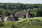
Forstal Road, Forstal geograph.org.uk 1733771

Forstal is a settlement in Aylesford parish in Kent, England.

Excerpt from the Wikipedia article Forstal (License: CC BY-SA 3.0, Authors, Images).

Forstal
Beddow Way, Tonbridge and Malling Aylesford

Geographical coordinates (GPS) Address Nearby Places
placeShow on map

Wikipedia: ForstalContinue reading on Wikipedia

Geographical coordinates (GPS)

Latitude Longitude
N 51.303575 ° E 0.493097 °
placeShow on map

Address

Beddow Way

Beddow Way
ME20 7UU Tonbridge and Malling, Aylesford
England, United Kingdom
mapOpen on Google Maps

Forstal Road, Forstal geograph.org.uk 1733771
Share experience

Nearby Places

Allington Quarry Waste Management Facility

The Allington Quarry Waste Management Facility is an integrated waste management centre in Allington, Kent. It is the site of the Allington Energy from Waste (EfW) Incinerator. The incinerator is owned by FCC Environment as Kent Enviropower. The facility, which has involved an investment of over £150 Million, is able to process 500,000 tonnes per annum of waste and has the ability to produce 40MW of power. The facility takes non-hazardous waste from households and businesses in Kent and the surrounding area for recycling and energy recovery. Materials separated by householders are sorted and sent for recycling, with the remainder being used to generate electricity to power the facility and for the local supply network. Built in a former ragstone quarry, the site includes one 80 metres (260 ft) high chimney, and covers an area of 84 acres (34 ha), of which 67 acres (27 ha) will eventually become parkland, and permanently employs around 100 people.Under a 25-year contract with Kent County Council, Over 325,000 tonnes of municipal waste, from Maidstone, Sevenoaks, Tunbridge Wells, Tonbridge and Malling, Dartford, Gravesham and Swale councils will be processed each year. The centre is a major waste facility and will contribute to Kent meeting its LATS obligations for the diversion of waste from landfill. The incinerator employs fluidized bed incineration technology and has been in commercial operation since December 2008.

Coffin Stone
Coffin Stone

The Coffin Stone, also known as the Coffin and the Table Stone, is a large sarsen stone at the foot of Blue Bell Hill near Aylesford in the south-eastern English county of Kent. Now lying horizontally, the stone probably once stood upright nearby. Various archaeologists have argued that the stone was part of a now-destroyed chambered long barrow constructed in the fourth millennium BCE, during Britain's Early Neolithic period. If a chambered long barrow did indeed previously exist on the site, it would have been built by pastoralist communities shortly after the introduction of agriculture to Britain from continental Europe. Long-barrow building was an architectural tradition widespread across Neolithic Europe. It consisted of various localized regional variants; one of these was in the vicinity of the River Medway, examples of which are now known as the Medway Megaliths. The Coffin Stone lies on the eastern side of the river, not far from the chambered long barrows of Little Kit's Coty House, Kit's Coty House, and the (now destroyed) Smythe's Megalith. Three other examples, the Coldrum Long Barrow, Addington Long Barrow, and Chestnuts Long Barrow, remain on the western side of the river. The Coffin Stone is a rectangular slab lying flat that measures 4.42 metres (14 ft 6 in) in length, 2.59 metres (8 ft 6 in) in breadth, and about 0.61 metres (2 ft) in width. Two smaller stones lie nearby and another large slab is now located atop it. In the 1830s it was reported that local farmers found human bones near the stone. An archaeological excavation of the site led by Paul Garwood took place in 2008–09; it found that the megalith was placed in its present location only in the 15th or 16th centuries. The archaeologists found no evidence of a chambered long barrow at the location, and suggested that the Coffin Stone might once have stood upright in the vicinity.

Medway Megaliths
Medway Megaliths

The Medway Megaliths, sometimes termed the Kentish Megaliths, are a group of Early Neolithic chambered long barrows and other megalithic monuments located in the lower valley of the River Medway in Kent, South-East England. Constructed from local sarsen stone and soil between the 4th and 3rd millennia BCE, they represent the only known prehistoric megalithic group in eastern England and the most south-easterly group in Britain. They remain one of several regionally contained chambered long barrow traditions in Britain, although have certain precise architectural characteristics which mark them out as distinct from other groups. The purpose of these long barrows remains elusive, although some were used as tombs for the remains of a select group of individuals. It is also widely believed that they were places where religious rituals were performed. Many archaeologists believe that they reflect the process of Neolithisation of Britain, as hunter-gatherer populations were replaced by pastoralists. Three chambered tombs have been identified to the west of the river: the Coldrum Stones, Addington Long Barrow, and Chestnuts Long Barrow. To the east of the river, another three chambered tombs have been identified: Kit's Coty House, Little Kit's Coty House, and Smythe's Megalith, although it has also been suggested that two nearby megaliths, the Coffin Stone and the White Horse Stone, are remnants of former chambered tombs. An Early Neolithic longhouse and causewayed enclosure have also been identified in the vicinity of the monuments. The Medway Megaliths have become heavily damaged and dilapidated since original construction, largely due to an intentional program of destruction in the late 13th century CE. They began to attract the interest of antiquarians in the late 16th century, who developed a number of erroneous theories about their origin, before later being scientifically investigated by archaeologists in the late 19th century. Local folklore has also grown up around the monuments, which came to be interpreted and used as sacred sites by contemporary Pagans in the latter 20th century.

Little Kit's Coty House

Little Kit's Coty House, also known as Lower Kit's Coty House and the Countless Stones, is a chambered long barrow located near to the village of Aylesford in the southeastern English county of Kent. Constructed circa 4000 BCE, during the Early Neolithic period of British prehistory, today it survives in a ruined state. Archaeologists have established that the monument was built by pastoralist communities shortly after the introduction of agriculture to Britain from continental Europe. Although representing part of an architectural tradition of long barrow building that was widespread across Neolithic Europe, Kit's Coty House belongs to a localised regional variant of barrows produced in the vicinity of the River Medway, now known as the Medway Megaliths. Of these, it lies near to both Kit's Coty House and the Coffin Stone on the eastern side of the river. Three further surviving long barrows, Addington Long Barrow, Chestnuts Long Barrow, and Coldrum Long Barrow, are located west of the Medway. Now a jumble of half-buried sarsen stones it is thought to have been a tomb similar to that of the Coldrum Stones. The name is derived from the belief that the chaotic pile of stones from the collapsed tomb were uncountable and various stories are told about the fate of those who tried. Another nearby site that may have been Neolithic is at Cossington. There are between 19 and 21 stones depending on the authority. They were pushed over in the seventeenth century seemingly before any antiquarian interest was taken in them. William Stukeley attempted to reconstruct the damaged tomb in plan in the eighteenth century. Archaeological evaluation trenching in 1989 found no clear evidence of any surrounding quarry ditch which would normally have been excavated to provide material for a covering barrow.