Mundaring Weir
1903 establishments in AustraliaDams completed in 1951Dams in Western AustraliaGoldfields Water Supply SchemeHelena River ... and 3 more
Mundaring WeirUse Australian English from November 2015Weirs

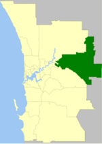
Mundaring Weir is a concrete gravity dam (and historically the adjoining locality) located 39 kilometres (24 mi) from Perth, Western Australia in the Darling Scarp. The dam and reservoir form the boundary between the suburbs of Reservoir and Sawyers Valley. The dam impounds the Helena River.
Excerpt from the Wikipedia article Mundaring Weir (License: CC BY-SA 3.0, Authors, Images).Mundaring Weir
Mundaring Weir Road, City Of Kalamunda
Geographical coordinates (GPS) Address Nearby Places Show on map
Geographical coordinates (GPS)
| Latitude | Longitude |
|---|---|
| N -31.96 ° | E 116.1713 ° |
Address
Mundaring Weir Road
Mundaring Weir Road
City Of Kalamunda, Paulls Valley (Reservoir)
Western Australia, Australia
Open on Google Maps


