place

Pemberwick, Connecticut

Census-designated places in ConnecticutCensus-designated places in Fairfield County, ConnecticutGreenwich, ConnecticutNeighborhoods in ConnecticutPopulated coastal places in Connecticut
Use mdy dates from July 2023
Fairfield County Connecticut incorporated and unincorporated areas Pemberwick highlighted

Pemberwick is a neighborhood/section and census-designated place in Greenwich in Fairfield County, Connecticut, United States. As of the 2010 census it had a population of 3,680.

Excerpt from the Wikipedia article Pemberwick, Connecticut (License: CC BY-SA 3.0, Authors, Images).

Pemberwick, Connecticut
Morgan Avenue,

Geographical coordinates (GPS) Address Nearby Places
placeShow on map

Wikipedia: Pemberwick, ConnecticutContinue reading on Wikipedia

Geographical coordinates (GPS)

Latitude Longitude
N 41.025555555556 ° E -73.660833333333 °
placeShow on map

Address

Morgan Avenue 20
06831
Connecticut, United States
mapOpen on Google Maps

Fairfield County Connecticut incorporated and unincorporated areas Pemberwick highlighted
Share experience

Nearby Places

Glenville Historic District

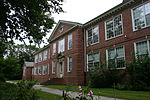
Glenville Historic District, also known as Sherwood's Bridge, is a 33.9 acres (13.7 ha) historic district in the Glenville neighborhood of the town of Greenwich, Connecticut. It is the "most comprehensive example of a New England mill village within the Town of Greenwich". It "is also historically significant as one of the town's major staging areas of immigrants, predominantly Irish in the 19th century and Polish in the 20th century" and remains "the primary settlement of Poles in the town". Further, "[t]he district is architecturally significant because it contains two elaborate examples of mill construction, designed in the Romanesque Revival and a transitional Stick-style/Queen Anne; an excellent example of a Georgian Revival school; and notable examples of domestic and commercial architecture, including a Queen Anne mansion and an Italianate store building.": 13 It was listed on the National Register of Historic Places in 2007. At that time, it included 43 contributing buildings, 4 other contributing structures, and 4 contributing sites. The district is drawn to include the core area of the neighborhood, and it includes a mill property, although it omits an adjacent condominium complex. It is drawn also to exclude "a shopping center and the one-family houses of Angelus Drive, both areas dating from the 1960s." It also excludes various other commercial and residential areas of Glenville.: 22 Significant properties in the district include: One Glenville Street, "the most notable commercial building in the district, the result of an 1882 expansion of a smaller building in the Italianate style" the Glenville School, which is separately listed on the NRHP Cornell's Castle, a Queen Anne style mansion (see accompanying photo #8) New Mill building, built in 1881 in Romanesque Revival style with corbelled battlements, dentil courses, pilasters, and other details (see photo #9): 7  Depot Building, aka Picking Building, a "transitional Stick style/Queen Anne design" building constructed in 1879 anticipating a railroad that was never built (see photo #10): 7  Webster Haight House, 1872 Italianate house, 25 Glenville Street Pottgen House, 1898, Queen Anne style house, 9 Glenville Street Glenville Firehouse, 1950, Georgian Revival, 266 Glenville Road a concrete arch bridge, from 1948, on Glenville Street 11 Glenville Street, an Italianate house built in 1855 and expanded by John Sherwood in 1882: 10 It is located at falls of the Byram River, which provided waterpower when this was a mill village.

Bush-Lyon Homestead
Bush-Lyon Homestead

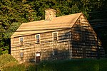
Bush-Lyon Homestead is a historic home located at Port Chester, Westchester County, New York. The earliest part was built about 1720. It is a 1+1⁄2-story, five-by-two-bay, frame residence faced in shingles and clapboards. It has a center stone chimney. The rear kitchen wing and 1-story north wing were added about 1800 and the house given its saltbox configuration. In the mid-19th century, the present porch was added with its Doric order piers and a 1-story, gable-roofed wing added. Also on the property are a carriage house, former slave quarters, and a storage building / corn crib. The property was purchased by the village in 1925 from the Bush estate. It served as headquarters for General Israel Putnam, 1777–1778.It was added to the National Register of Historic Places in 1982.History of the Homestead : The home may have been built by John Lyon II, born 1693, who had considerable farm land that included the area now called Lyon Park. There is considerable evidence that the house existed before the marriage of his daughter Ruth Lyon to Abraham Bush, who made the house their homestead. It may have been occupied by one or more of John Lyon II's sons. John Lyon II's children were: John Lyon (1713-1790); Roger Lyon (1715-1797); Elizabeth (Lyon) Treadwell (1718-1772); James Lyon (1720-1804); Ruth Lyon (1724-1802). Ruth Lyon and Abraham Bush were married c.1744. They had seven children, all born at the house between 1747 and 1766. Their son Gilbert Bush (1753-1831) married Sabrina Seymour and had one daughter Mary Emeline Bush (born about 1799, died 1893), who inherited the house. Emeline married Gershom Bulkley of Port Chester, from a family of sea merchants in the area. They had seven children born in the house, all of whom pre-deceased Mary Emeline. Upon her death, questions arose as to the ownership and preservation of the home, and after a series of court hearings involving distance relatives, the house and property were purchased by the Village of Port Chester in 1925 and preserved as a park. The Port Chester Historical Society maintains its headquarters at the homestead and welcomes any visitors to tour the homestead when the homestead is open to the public.