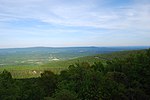
Largent, West Virginia
Largent is an unincorporated community village located chiefly in Morgan County and partly in Hampshire County in the U.S. state of West Virginia. Largent is located on the Cacapon River, approximately 18 miles southwest of Berkeley Springs along Cacapon Road (West Virginia Route 9). It is located by Old Enon Cemetery, Stony Creek, and the Cacapon River. Largent's original town name was Enon. It was most likely renamed when Postal Service found another town of Enon elsewhere in the state. The Enon name is found in local church and cemetery names. The Enon school is found on USGS maps from 1914 through 1923 (Capon Bridge maps). The school has been open at least since the 1930s. The Baileys bought the building in 1958 and it has been a residence since. The Largent Bridge was built in the 1930s during the New Deal. Initially it was a one lane bridge, but it was quickly expanded to be a two-way bridge. The addition (difference in concrete) can be seen from underneath the bridge.
Excerpt from the Wikipedia article Largent, West Virginia (License: CC BY-SA 3.0, Authors).Largent, West Virginia
Kilgore Lane,
Geographical coordinates (GPS) Address Nearby Places Show on map
Geographical coordinates (GPS)
| Latitude | Longitude |
|---|---|
| N 39.477777777778 ° | E -78.382222222222 ° |
Address
Kilgore Lane
Kilgore Lane
West Virginia, United States
Open on Google Maps


