place

Harrison Island (Maryland)

Islands of the Potomac RiverLandforms of Montgomery County, MarylandMontgomery County, Maryland geography stubsRiver islands of Maryland

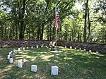
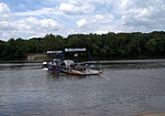
Harrison Island is private farming island in Montgomery County, Maryland, United States. It is located between the Potomac River on the Maryland side, and Ball's Bluff Battlefield and National Cemetery on the Virginia side, next to Leesburg, Virginia. The island dominates the view from the heights of Ball's Bluff Battlefield. Among the low, flood-prone islands of the lower Potomac River, Harrison Island is notable for having a permanent private residence visible near the center of the island. There are no bridges to the island. Currently the island is closed to the general public.

Excerpt from the Wikipedia article Harrison Island (Maryland) (License: CC BY-SA 3.0, Authors).

Harrison Island (Maryland)
Smart's Mill Road,

Geographical coordinates (GPS) Address Nearby Places
placeShow on map

Wikipedia: Harrison Island (Maryland)Continue reading on Wikipedia

Geographical coordinates (GPS)

Latitude Longitude
N 39.135254 ° E -77.522403 °
placeShow on map

Address

Smart's Mill Road

Smart's Mill Road
20176
Maryland, United States
mapOpen on Google Maps

Share experience

Nearby Places

Rockland (Leesburg, Virginia)

Rockland is the home of Virginia's Rust family, near Leesburg, Virginia. The property housed slaves to work their farm. The property was acquired by General George Rust from the heirs of Colonel Burgess Ball in 1817. General Rust built the present brick residence about 1822, incorporating an older frame house as a rear service wing. General Rust was involved in the Baltimore area during the War of 1812 and was a member of the Virginia House of Delegates in 1818-1819 and 1820–1823. The 1850 U.S. Federal Census - Slave Schedules lists 33 slaves as being owned by George Rust of Loudon County. The Rust of Virginia genealogy is available online and lists names and transactions for some of the enslaved. On his death in 1857 the house passed to his son, Colonel Armistead Thompson Mason Rust. Born at Rockland in 1820, Colonel Rust attended West Point and served with the Confederate 19th Virginia Infantry during the American Civil War. On Colonel Rust's death in 1887, his son Henry Bedinger Rust inherited the property. Henry enlarged the house in 1908 to its present configuration. The house continues to be owned by the Brown family, descendants of the Rusts through Henry's daughter Elizabeth Fitzhugh Rust Brown.The Federal style house has a central hall, single pile plan, extended by the 1908 additions to a double-pile plan. A one-story Roman Doric portico was added to the south elevation in 1908, while the rear (east) elevation has a Roman Doric porch across its width. The property includes a number of outbuildings, including a brick overseer's residence, brick slave quarters, a smokehouse, a small barn, a farm supervisor's house and a variety of twentieth century buildings.Rockland was listed on the National Register of Historic Places in 1987.Reference Rust, Ellsworth M. Rust of Virginia Genealogical and Biological Sketches of the Descendents of William Rust 1654–1940. Washington, 1940. http://wvancestry.com/ReferenceMaterial/Files/Rust_of_Virginia;_genealogical_and_biographical_sketches_of_the_descendants_of_William_Rust_1654-1940.pdf

Carlheim
Carlheim

Carlheim (also called Paxton) is a mansion located in the northeast part of Leesburg, Virginia. It was constructed in about 1872 for Pennsylvania industrialist Charles R. Paxton (1816–1889) and his wife Rachel who continued to live there until her death in December 1921. When constructed, it sat on over 760 acres (3.1 km2) roughly bounded on the north end by the Red Rock Wilderness Overlook Regional Park, the Balls Bluff Battlefield and the Potomac River. In accordance with Mrs. Paxton's will, the buildings and 50 surrounding acres were preserved and organized into a charitable trust to benefit "needy children." Designed by New York architect Henry Dudley, the nearly 20,000-square-foot (1,900 m2) 32-room Second Empire building was listed on the National Register of Historic Places in 1979 for its architectural and local significance. In 2004, the property became a non-contiguous part of the Leesburg Historic District. The estate of Mr. and Mrs. Paxton was originally entered down a long tree lined driveway off of King Street. Today, that entrance is gone and there are two more contemporary entrances; Wildman Street (normally closed) and the new main entrance that was completed in 2009 at 601 Catoctin Circle. Among the buildings that remain from the original estate but are outside the present campus include the Farm Managers Home (now the Exeter Community Club House) and the stabilized creamery ruins at Red Rock Park along Edwards Ferry Road. The mansion and remaining 16-acre (65,000 m2) grounds are currently the home of The Arc of Loudoun, Northern Virginia's premier advocacy, education and therapy organization dedicated to serving people with disabilities and their families. The Arc's constituents encompass all ages and ranges of intellectual/developmental disabilities (I/DD), cognitive impairments, and other neurodevelopmental disorders (to include Autism Spectrum Disorder, Down Syndrome, and Fragile X); and/or neurophysical injuries and dysfunctions (to include spinal cord and brain injuries, stroke, Multiple Sclerosis, Parkinson's Disease, cerebral palsy, and balance disorders). The Arc's onsite programs include Ability Fitness Center, Aurora Behavior Clinic, Aurora School, A Life Like Yours ALLY Advocacy Center, and Open Door Learning Center. The Campus is privately owned property but holds several events open to the general public. The major annual fundraising events on the property include: Music at the Manor free concert series (May) Shocktober Haunted House (One of The Scariest Haunted Houses in the US) (October) My Bloody Valentine Haunted House (February)