place

Magdalen Ground

1829 establishments in England1917 disestablishments in EnglandCricket grounds in OxfordshireDefunct cricket grounds in EnglandDefunct football venues in England
Magdalen College, OxfordOxford University Cricket ClubParks and open spaces in OxfordSport at the University of OxfordSports venues completed in 1829Sports venues in OxfordUniversity of Oxford sitesUse British English from February 2023

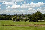
The Magdalen Ground (also known as the Old Magdalen Ground) was a cricket ground in Oxford, England. The ground was owned by the University of Oxford and used by Magdalen College, a constituent college of the University of Oxford. Originally forming the northern point of Cowley Marsh, the ground was initially associated with the Magdalen College School, whose students played cricket there. By 1829, the Oxford University Cricket Club had been given a part of the marsh where the College School played cricket. In 1851, it was purchased at auction by the University of Oxford and leased to the University Cricket Club. The ground operated as a first-class cricket venue from 1829 to 1880, hosting 69 first-class matches. The University Cricket Club left the ground following the 1880 season to play at the University Parks from 1881.

Excerpt from the Wikipedia article Magdalen Ground (License: CC BY-SA 3.0, Authors).

Magdalen Ground
Ridgefield Road, Oxford

Geographical coordinates (GPS) Address Nearby Places
placeShow on map

Wikipedia: Magdalen GroundContinue reading on Wikipedia

Geographical coordinates (GPS)

Latitude Longitude
N 51.7435 ° E -1.2295 °
placeShow on map

Address

Ridgefield Road 15
OX4 3BT Oxford
England, United Kingdom
mapOpen on Google Maps

Share experience

Nearby Places

Morrell Avenue
Morrell Avenue

Morrell Avenue is a residential tree-lined road in Headington, east Oxford, England.The road runs east–west in a gentle curve around the southern edge of South Park, south of Headington Hill, rising from west to east. At the western end is a junction with St Clement's (A420), part of the main arterial road leading east out of Oxford. At the eastern end of the road is a roundabout close to Warneford Hospital. It continues as Warneford Lane and there is a junction with Divinity Road to the south. The trees are mainly mature lime trees. The avenue is named after a local brewery family, the Morrells, who used to live on their estate at Headington Hill Hall to the north, including South Park. It was built in 1929–31, originally with council houses. The architect, Kellett Ablett, started working in the City Engineer's department at Oxford in 1925. The houses were judged to be of high quality for the time, both architecturally and environmentally.Morrell Avenue is mentioned in a number of books including The Silent Traveller in Oxford, originally published in 1944 and written by the Chinese author Chiang Yee, who lived in Oxford for a while. It is also mentioned in the book Dark Clouds Gather by Katy Sara Culling about mental illness due to Morrell Avenue's proximity to Warneford Hospital, which specialises in mental illness.On 9 July 2012, the Olympic torch was carried along Morrell Avenue before the London 2012 Olympic Games.