place

Clifton and Lowther railway station

1846 establishments in EnglandClifton, CumbriaDisused railway stations in CumbriaFormer Lancaster and Carlisle Railway stationsPages with no open date in Infobox station
Railway stations in Great Britain closed in 1938Railway stations in Great Britain opened in 1846Use British English from January 2018
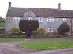
Clifton & Lowther station site vicinity geograph 3111582 by Ben Brooksbank

Clifton & Lowther railway station was a station on the Lancaster and Carlisle Railway (L&CR) south of Penrith near to the village of Clifton. Although it was the original terminus to cross Pennines rail traffic on the Eden Valley Railway, it was rapidly by-passed by a new line and junction. The station, which was on the West Coast Main Line, was treated as a private stop by the Earls of Lonsdale.

Excerpt from the Wikipedia article Clifton and Lowther railway station (License: CC BY-SA 3.0, Authors, Images).

Clifton and Lowther railway station
Clifton Moor Cottages,

Geographical coordinates (GPS) Address Nearby Places
placeShow on map

Wikipedia: Clifton and Lowther railway stationContinue reading on Wikipedia

Geographical coordinates (GPS)

Latitude Longitude
N 54.618276 ° E -2.713119 °
placeShow on map

Address

Clifton & Lowther Junction

Clifton Moor Cottages
CA10 2EZ , Clifton
England, United Kingdom
mapOpen on Google Maps

Clifton & Lowther station site vicinity geograph 3111582 by Ben Brooksbank
Share experience

Nearby Places

Leath

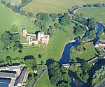
Leath was one of the wards of the historic county of Cumberland in north west England. Unlike most other English counties, Cumberland was divided into wards rather than hundreds. The ward was bounded on the south by Westmorland, the north by Cumberland and Eskdale wards, the east by the counties of Northumberland and Durham and on the west by the wards of Allerdale above Derwent and Allerdale below Derwent. In the Imperial Gazetteer of England and Wales (1870–72) John Marius Wilson described Leath: LEATH, a ward in Cumberland; bounded by Northumberland, Durham, and Westmoreland, and by the wards of Eskdale and Allerdale; and containing Addingham parish, twenty other parishes, and part of another. Acres, 216,296. Pop. in 1851, 29,103; in 1861, 28,675. Houses, 5,819. The ward largely corresponds to that part of the modern Eden District that lies within Cumberland that is the former Penrith urban and rural districts and the Alston with Garrigill Rural District. Market towns in the ward were Penrith (the largest settlement and seat of local government), Kirkoswald and Alston. At one time, the village of Greystoke had held markets. A large part of the ward once made up the main part of the Royal hunting ground known as Inglewood Forest, which was subject to Forest Laws up until the reign of Henry VIII. The manors of Penrith, Langwathby, Castle Sowerby and Great Salkeld and at times Glassonby and Gamblesby were part of the royal estate known as the Honour of Penrith, which eventually passed into the hands of the Dukes of Devonshire.

Brougham, Cumbria
Brougham, Cumbria

Brougham is a small village (or more properly a collection of hamlets) and civil parish on the outskirts of Penrith in the Eden District of Cumbria, England. According to the 2001 census the parish had a population of 279, falling marginally to 277 at the 2011 Census.Within the parish are the remains of Brocavum Roman fort. The ruins of the medieval Brougham Castle, once home to Lady Anne Clifford, are next to the fort. The mainly 19th century Brougham Hall, the former seat of the Lords Brougham and Vaux is nearby. The 17th-century Countess Pillar, set up by Lady Anne, is beside the A66 near the castle. The parish has two Anglican churches: The historic Ninekirks, dedicated to St Ninian, is situated by the banks of the River Eamont and was extensively rebuilt by Lady Anne Clifford. It was previously a Norman foundation, probably on the site of an earlier Anglo-Saxon church. There is reputed to have been an even more ancient monastery nearby, founded by St Ninian (see also History of Cumbria). St Wilfred's or Brougham Chapel is next to the hall, overlooking the River Lowther.Brougham "village" itself is no more than a scattering of farms and modern housing near the hall and is, along with neighbouring Eamont Bridge, often classed as an outlying suburb of Penrith. There are some more cottages next to the castle, which is partially built on the site of the Roman fort. Within the parish is Whinfell Forest the site of a Red squirrel reserve, a Center Parcs holiday village, and the site of RAF Hornby Hall World War II aerodrome.