place

Lowther, Cumbria

Civil parishes in CumbriaCumbria geography stubs
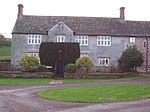
Model Village, Lowther geograph.org.uk 59691

Lowther is a civil parish in Westmorland and Furness, Cumbria. Within the parish are the settlements of Lowther Village, Newtown or Lowther Newtown, Hackthorpe, Whale, and Melkinthorpe. At the 2001 census the parish had a population of 402, increasing to 465 at the 2011 Census.The parish council meets at the Lowther Parish Hall in Hackthorpe. Lowther Endowed Primary School is also at Hackthorpe. Most of the land in the parish belongs to the Lowther family estates. The family seat of the Lowthers was formerly Lowther Castle which is now a ruin but set in spectacular parkland. Hackthorpe once had its own magistrates' court which is now part of the village's pub. A large part of the parish is within the Lake District National Park.

Excerpt from the Wikipedia article Lowther, Cumbria (License: CC BY-SA 3.0, Authors, Images).

Lowther, Cumbria
Emperor's Drive,

Geographical coordinates (GPS) Address Nearby Places
placeShow on map

Wikipedia: Lowther, CumbriaContinue reading on Wikipedia

Geographical coordinates (GPS)

Latitude Longitude
N 54.5969 ° E -2.7314 °
placeShow on map

Address

Emperor's Drive

Emperor's Drive
CA10 2HJ , Lowther
England, United Kingdom
mapOpen on Google Maps

Model Village, Lowther geograph.org.uk 59691
Share experience

Nearby Places

Lowther Castle
Lowther Castle

Lowther Castle is a crenellated country house in the historic county of Westmorland, which now under the current unitary authority of Westmorland and Furness, in the ceremonial county of Cumbria, England . The estate has belonged to the Lowther family, latterly the Earls of Lonsdale, since the Middle Ages. It is a fully managed ruin, open to visits by the public to the shell of the castle and some of the gardens since 2011. Additional work was completed since that time, most recently on the extensive gardens. Francis Knollys escorted Mary, Queen of Scots to Lowther Hall (as the house was then known) on 13 July 1568 on her way to Wharton Hall and Bolton Castle. In the late 17th century, the 1st Viscount Lonsdale rebuilt the family home, then known as Lowther Hall, on a grand scale. The current building is a castellated mansion which was built by Robert Smirke for the 1st Earl of Lonsdale between 1806 and 1814, and it was only at that time that the site was designated a "castle". The family fortune was undermined by the extravagance of the 5th Earl of Lonsdale, a famous socialite, and the castle was closed in 1937. During the Second World War, it was used by a tank regiment. Its contents were removed in the late 1940s and the roof was removed in 1957. The shell is still owned by the Lowther Estate Trust. George Macartney, when visiting the summer retreat of the Chinese emperor in Chengde in 1793, could compare the magnificence of what he saw only with Lowther Hall: “If any place in England can be said in any respect to have similar features to the western park, which I have seen this day, it is Lowther Hall in Westmoreland, which (when I knew it many years ago) from the extent of prospect, the grand surrounding objects, the noble situation, the diversity of surface, the extensive woods, and command of water, I thought might be rendered by a man of sense, spirit, and taste, the finest scene in the British dominions.”In the 19th century, an East India Company ship, HCS Lowther Castle, was named after the estate.

Leath

Leath was one of the wards of the historic county of Cumberland in north west England. Unlike most other English counties, Cumberland was divided into wards rather than hundreds. The ward was bounded on the south by Westmorland, the north by Cumberland and Eskdale wards, the east by the counties of Northumberland and Durham and on the west by the wards of Allerdale above Derwent and Allerdale below Derwent. In the Imperial Gazetteer of England and Wales (1870–72) John Marius Wilson described Leath: LEATH, a ward in Cumberland; bounded by Northumberland, Durham, and Westmoreland, and by the wards of Eskdale and Allerdale; and containing Addingham parish, twenty other parishes, and part of another. Acres, 216,296. Pop. in 1851, 29,103; in 1861, 28,675. Houses, 5,819. The ward largely corresponds to that part of the modern Eden District that lies within Cumberland that is the former Penrith urban and rural districts and the Alston with Garrigill Rural District. Market towns in the ward were Penrith (the largest settlement and seat of local government), Kirkoswald and Alston. At one time, the village of Greystoke had held markets. A large part of the ward once made up the main part of the Royal hunting ground known as Inglewood Forest, which was subject to Forest Laws up until the reign of Henry VIII. The manors of Penrith, Langwathby, Castle Sowerby and Great Salkeld and at times Glassonby and Gamblesby were part of the royal estate known as the Honour of Penrith, which eventually passed into the hands of the Dukes of Devonshire.