Kennington, Kent
Ashford, KentCivil parishes in KentVillages in Kent

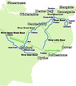
Kennington is a suburb of Ashford and civil parish in Kent, England. It is about a mile northeast of the town centre and north of the M20 motorway, and contains the 12th-century church, St Mary's. The main A28 Canterbury Road and A2042 Faversham Road run through the village, and the A251 Trinity Road skirts the western edge. In recent years the village has expanded with the building of new housing estates in Little Burton, Trinity Road, Conningbrook Lakes, and planned for Conningbrook Park and Eureka Park. The Great Stour river and the Kennington stream run through the area.
Excerpt from the Wikipedia article Kennington, Kent (License: CC BY-SA 3.0, Authors, Images).Kennington, Kent
Hillcrest Close,
Geographical coordinates (GPS) Address Nearby Places Show on map
Geographical coordinates (GPS)
| Latitude | Longitude |
|---|---|
| N 51.1674 ° | E 0.8918 ° |
Address
Hillcrest Close
TN24 9QT , Bybrook
England, United Kingdom
Open on Google Maps


