Diep River, Cape Town
Suburbs of Cape Town

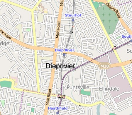
Diep River is a suburb in Cape Town, South Africa, named after the Diep River that runs through the area. The suburb is bordered by Heathfield to the south and Plumstead to the north. Diep River railway station is on the main line from Cape Town to Simon's Town.
Excerpt from the Wikipedia article Diep River, Cape Town (License: CC BY-SA 3.0, Authors, Images).Diep River, Cape Town
Ruchill Road,
Geographical coordinates (GPS) Address Nearby Places Show on map
Geographical coordinates (GPS)
| Latitude | Longitude |
|---|---|
| N -34.034166666667 ° | E 18.464444444444 ° |
Address
Ruchill Road 3
7800 , Diep River
Western Cape, South Africa
Open on Google Maps


