Oak Grove Heights, Missouri
Southwest Missouri geography stubsSpringfield metropolitan area, MissouriUnincorporated communities in Greene County, MissouriUnincorporated communities in MissouriUse mdy dates from July 2023

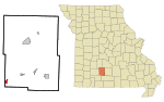
Oak Grove Heights is an unincorporated community in eastern Greene County, Missouri, United States. It is located on Route 125, approximately five miles northwest of Rogersville and one mile south of the James River.The community grew around the location of the Oak Grove School which was two miles west of the James River community of Turners and just northeast of Turner Creek and the old St. Louis–San Francisco Railway (currently the BNSF Railway) which followed the stream course.
Excerpt from the Wikipedia article Oak Grove Heights, Missouri (License: CC BY-SA 3.0, Authors, Images).Oak Grove Heights, Missouri
Brunshausen,
Geographical coordinates (GPS) Address Nearby Places Show on map
 Continue reading on Wikipedia
 Geographical coordinates (GPS)
| Latitude | Longitude |
|---|---|
| N 37.173888888889 ° | E -93.118611111111 ° |
Address
Brunshausen 7
37581 , Vorwerk Brunshausen
Niedersachsen, Deutschland
Open on Google Maps