place

Old Weston

Civil parishes in CambridgeshireHuntingdonshireUse British English from June 2016Villages in Cambridgeshire
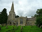
Old Weston church geograph.org.uk 1631496

Old Weston – in Huntingdonshire (now part of Cambridgeshire), England – is a village near Molesworth west of Huntingdon.In 1870–1872, John Wilson, who was a writer for the "Imperial Gazetteer of England and Wales:" describes the area as, "a parish, with a scattered village, in the district of Thrapston and county of Huntingdon; 8 miles N of Kimbolton r. station. It has a post-office under St. Neots. Acres, 2,012. Real property, £2,364. Pop., 426. Houses, 93. The property is much sub-divided. The living is a p. curacy, annexed to Brington. The church is ancient but good, and has a tower and spire. There are a Wesleyan chapel and a national school." According to the 2011 UK population census, the parish of Old Weston had a population of 250 people.

Excerpt from the Wikipedia article Old Weston (License: CC BY-SA 3.0, Authors, Images).

Old Weston
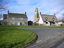
Main Street, Huntingdonshire Old Weston

Geographical coordinates (GPS) Address Nearby Places
placeShow on map

Wikipedia: Old WestonContinue reading on Wikipedia

Geographical coordinates (GPS)

Latitude Longitude
N 52.384 ° E -0.386 °
placeShow on map

Address

Main Street

Main Street
PE28 5LN Huntingdonshire, Old Weston
England, United Kingdom
mapOpen on Google Maps

Old Weston church geograph.org.uk 1631496
Share experience

Nearby Places

Stow Longa

Stow Longa is a village and civil parish in Cambridgeshire, England. Stow Longa lies approximately 8 miles (13 km) west of Huntingdon and two miles north of Kimbolton. Stow Longa is situated within Huntingdonshire which is a non-metropolitan district of Cambridgeshire as well as being a historic county of England. Stow Longa's original name was Stow or Long Stow, which comes from the Old English word stōw (meaning 'holy place') and the Latin word longa or Old English lang (meaning 'long'). Altogether, Stow Longa's name may mean 'the long holy place' or 'an extended settlement which is a holy place', though this is only a rough guess. Stow was also thought to have been the name of the pre-Conquest estate, which, in the medieval period, was split between two parishes: one, Over Stow or Upper Stow, the western part, which belonged to the Kimbolton parish, and the other, Estou (also Nether Stow or Long Stow), the eastern part, which was part of the soke of Spaldwick. Mistakenly described as a hamlet, it has the suitable number of houses and businesses to make it a village. Stow Longa is a village that is still void of any street lamps, village shops, a school or a public house. Sewer drainage came to the village in 2009. However, Stow Longa does possess several thatched cottages, a village room, a blocked-up well (on the village green), a stone cross (discussed below) and mature elm trees that survived the Dutch elm disease crisis. RAF Kimbolton was opened as a bomber airfield on the southern edge of the village in 1941, and was operated by the USAAF from 1942 to 1945. According to a locally published collection of short stories, 'Ploughing Songs' by Damian Croft, the reason why the public houses that were in Stow Longa were closed down in the 1950s was because, "returning drovers used it to give a bad name to a few otherwise nameless women."