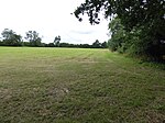
Monewden
Civil parishes in SuffolkEast Suffolk (district)Suffolk geography stubsVillages in Suffolk

Monewden ( MON-ə-dən) is a small village and a civil parish in the hundred of Loss (Also: Loes, Loose), in the East Suffolk District, in the English county of Suffolk. The population of the civil parish as of the 2011 census was 120. The village is located around 12 miles (19 km) north of Ipswich and 4 miles (6.4 km) west of Wickham Market. The village church is dedicated to St Mary. Two Sites of Special Scientific Interest are located in the parish, High House Meadows and Monewden Meadows, both areas of unimproved lowland grass meadow.
Excerpt from the Wikipedia article Monewden (License: CC BY-SA 3.0, Authors, Images).Monewden
Rookery Road, East Suffolk
Geographical coordinates (GPS) Address Nearby Places Show on map
Geographical coordinates (GPS)
| Latitude | Longitude |
|---|---|
| N 52.179 ° | E 1.274 ° |
Address
Rookery Road
Rookery Road
IP13 7DD East Suffolk
England, United Kingdom
Open on Google Maps


