place

Ayer, Massachusetts

1667 establishments in the Massachusetts Bay ColonyAyer, MassachusettsPages with plain IPAPopulated places established in 1667Towns in Massachusetts
Towns in Middlesex County, MassachusettsUse mdy dates from July 2023
Main Street, Ayer MA

Ayer ( AIR) is a town in Middlesex County, Massachusetts, United States. Originally part of Groton, it was incorporated February 14, 1871, and became a major commercial railroad junction. The town was home to Camp Stevens, a training camp for Massachusetts volunteers during the American Civil War. Later, Fort Devens was established by the federal government to train New England soldiers for World War I. Fort Devens is a major influence on the area, although it is considerably smaller than when it was first closed in the mid-1990s. The town's population was 8,479 at the 2020 census.

Excerpt from the Wikipedia article Ayer, Massachusetts (License: CC BY-SA 3.0, Authors, Images).

Ayer, Massachusetts
Park Street,

Geographical coordinates (GPS) Address Nearby Places
placeShow on map

Wikipedia: Ayer, MassachusettsContinue reading on Wikipedia

Geographical coordinates (GPS)

Latitude Longitude
N 42.561111111111 ° E -71.590277777778 °
placeShow on map

Address

Park Street 7
01432
Massachusetts, United States
mapOpen on Google Maps

Main Street, Ayer MA
Share experience

Nearby Places

Ayer station
Ayer station

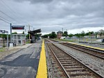
Ayer station is an MBTA Commuter Rail station located off Main Street (Route 2A/111) in the Ayer Main Street Historic District of Ayer, Massachusetts. It serves the Fitchburg Line. There are three tracks through the station, two of which are served by a pair of low-level side platforms, which are not accessible. There is a shelter on the inbound platform. Ayer has been a major railroad interchange since the Fitchburg Railroad opened through South Groton in 1845, followed by the Stony Brook Railroad, Worcester and Nashua Railroad, and Peterborough and Shirley Railroad in 1848. The original depot was replaced with a union station with a large trainshed in 1848. Land speculation and industrial development spurred by the railroad access expanded the tiny farm village into the independent town of Ayer. A new station was constructed in 1896. By 1900, the town was served by five lines all controlled by the Boston and Maine Railroad, with service to Boston, Worcester, and Lowell plus New York, New Hampshire, and Maine. Passenger service ended on all of the lines except the Fitchburg mainline between 1931 and 1961. After a brief disruption in early 1965, the Massachusetts Bay Transportation Authority began subsidizing commuter rail service to Ayer as part of what would become the Fitchburg Line. The station and part of the line was closed in 1975, but reopened in 1980. CSX Transportation also runs freight trains through the town to various destinations. Planning began in 2003 for a parking structure to serve park-and-ride commuters at the station. After delays caused by disagreements with a property owner, the property to ensure a public access route to the station was acquired by the town in June 2016, allowing the parking expansion to proceed. The garage opened in 2019, with improvements to the station entrance constructed in 2020–21.

Fort Devens Historic District

The Fort Devens Historic District is a historic district roughly bounded by El Caney St., Antietam St., Sherman Ave., MacArthur Ave. and Buena Vista Street in Devens, Massachusetts, encompassing territory in both Ayer and Harvard. The district is in a portion of the former Fort Devens and includes a large number of historically and architecturally significant buildings. The buildings that are deemed of most significant historic importance are those that were built in the period 1929-39. This building phase was begun after the United States Army decided to upgrade temporary facilities dating from World War I, to provide more permanent facilities at the base. This resulted in the construction of a significant number of Georgian Revival buildings in a rough U shape around a central parade ground. These buildings included dormitory facilities for soldiers, administrative office space, and warehouse facilities. This area is also significant as the site from 1933 to 1937 of an encampment of the Civilian Conservation Corps, and for its association with Congresswoman Edith Nourse Rogers, without whose efforts the base might have been closed instead of being upgraded.The district was added to the National Register of Historic Places in 1993. Its main boundaries on the north, west, and south, are Antietam and El Caney Streets. The eastern boundary is mainly Jackson Street, although there is an extension further eastward to Auman Avenue, where there are rows of single-family housing. One of the most visually dominant elements of the district are Rogers Field, the former parade ground, and the grouping of former barracks buildings on its north side.