place

Ayer Shirley Regional High School

Ayer, MassachusettsHigh schools in Middlesex County, MassachusettsMassachusetts school stubsPublic high schools in Massachusetts
Ayer Shirley High School, Ayer MA

Ayer Shirley Regional High School is a high school located in Ayer, Massachusetts. The school colors are maroon and white, and the mascot is the Panther. The student body contains about 350 students in 9th-12th grade.

Excerpt from the Wikipedia article Ayer Shirley Regional High School (License: CC BY-SA 3.0, Authors, Images).

Ayer Shirley Regional High School
Groton Harvard Road,

Geographical coordinates (GPS) Address External links Nearby Places
placeShow on map

Wikipedia: Ayer Shirley Regional High SchoolContinue reading on Wikipedia

Geographical coordinates (GPS)

Latitude Longitude
N 42.566666666667 ° E -71.575277777778 °
placeShow on map

Address

Ayer-Shirley Regional Schools

Groton Harvard Road
01432
Massachusetts, United States
mapOpen on Google Maps

linkWikiData (Q4831163)
linkOpenStreetMap (597539963)

Ayer Shirley High School, Ayer MA
Share experience

Nearby Places

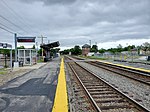
Ayer station
Ayer station

Ayer station is an MBTA Commuter Rail station located off Main Street (Route 2A/111) in the Ayer Main Street Historic District of Ayer, Massachusetts. It serves the Fitchburg Line. There are three tracks through the station, two of which are served by a pair of low-level side platforms, which are not accessible. There is a shelter on the inbound platform. Ayer has been a major railroad interchange since the Fitchburg Railroad opened through South Groton in 1845, followed by the Stony Brook Railroad, Worcester and Nashua Railroad, and Peterborough and Shirley Railroad in 1848. The original depot was replaced with a union station with a large trainshed in 1848. Land speculation and industrial development spurred by the railroad access expanded the tiny farm village into the independent town of Ayer. A new station was constructed in 1896. By 1900, the town was served by five lines all controlled by the Boston and Maine Railroad, with service to Boston, Worcester, and Lowell plus New York, New Hampshire, and Maine. Passenger service ended on all of the lines except the Fitchburg mainline between 1931 and 1961. After a brief disruption in early 1965, the Massachusetts Bay Transportation Authority began subsidizing commuter rail service to Ayer as part of what would become the Fitchburg Line. The station and part of the line was closed in 1975, but reopened in 1980. CSX Transportation also runs freight trains through the town to various destinations. Planning began in 2003 for a parking structure to serve park-and-ride commuters at the station. After delays caused by disagreements with a property owner, the property to ensure a public access route to the station was acquired by the town in June 2016, allowing the parking expansion to proceed. The garage opened in 2019, with improvements to the station entrance constructed in 2020–21.

Indian Hill House
Indian Hill House

Indian Hill House is a private residence named for the Indian Hills of Groton, Massachusetts, online at Indian Hill House. Designed in 1962-63 by Maurice K. Smith, the house was built by Ralph S. Osmond & Sons. The house appears in several architectural works, including the Harvard Art Review (1967), Harvard Educational Review (1969), Spazio e Societa (June 1982) as Casa/House 1, and Progressive Architecture (March 1982), [3 images w/o notation].An extensive photographic study of the house, then only a few years old, was taken for the Winter 1967 issue of Harvard Art Review. In his 1989 work, Architecture and Urbanism, Henry Plummer concluded of this house that it contained "innumerable locales, of fragmentary rooms loosely interlocked, of zones both intimate and grand, created for an almost endless array of eyes, and heads and bodies and voices, an abundance which no longer bears upon the needs of a single person. Not only does the building form evolve but it is never perceived by two persons in quite the same way." In his 1967 work, World Architecture 4, John Donat described this house as "a place that prescribes nothing, an architecture that is intense without imposing itself on you." He goes on to write that this family house is "a place of real options and opportunities [that] can be richly interpreted by whoever is living in it." MIT School of Architecture Chair Mark Jarzombek wrote in 2013, "Indian Hill House – in a more restrained clean modernist aesthetic — is different from [Smith's] own house in many respects. A series of low, concrete walls staggered across the crest of the hill rise up to meet wooden, glazed walls of slightly different heights. The whole is protected by shed-and-gable roofs designed to appear as thin and lightweight as possible."Indian Hill House is set on 7 acres (28,000 m2) at the uphill woodland end of Skyfields Drive. The property complements a nearly 500-acre (2.0 km2) preserve of surrounding woodland under care of the Groton Conservation Trust, Massachusetts Audubon Society, and Groton Conservation Commission. Its Indian Hill Road access was closed and the approach changed to Skyfields Drive when the original, larger property was subdivided in March 2000. During its planning and construction from 1962 to 1965, Indian Hill House was referred to by architect Smith as "Blackman House 1" to be followed in the 1990s by Blackman House 2 (Manchester-By-The-Sea). Blackman House 3 (Groton) was designed by others. Fifty-three drawings and photographs of the house are kept by the MIT Libraries.