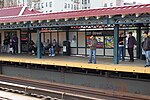
Kingsbridge Heights, Bronx
Kingsbridge Heights, BronxNeighborhoods in the Bronx
Kingsbridge Heights is a residential neighborhood geographically located in the northwest Bronx, New York City. Its boundaries are Van Cortlandt Park to the north, Jerome Avenue to the east, Kingsbridge Road to the south, and the Major Deegan Expressway to the west. Sedgwick Avenue is the primary thoroughfare through Kingsbridge Heights. The neighborhood is part of Bronx Community District 8, and its ZIP Codes include 10463 and 10468. The area is patrolled by the 50th and 52nd Precincts of the New York City Police Department. NYCHA property in the area is patrolled by P.S.A. 8 at 2794 Randall Avenue in the Throgs Neck section of the Bronx.
Excerpt from the Wikipedia article Kingsbridge Heights, Bronx (License: CC BY-SA 3.0, Authors).Kingsbridge Heights, Bronx
Sedgwick Avenue, New York The Bronx
Geographical coordinates (GPS) Address Nearby Places Show on map
Geographical coordinates (GPS)
| Latitude | Longitude |
|---|---|
| N 40.872 ° | E -73.902 ° |
Address
Sedgwick Avenue 2796
10468 New York, The Bronx
New York, United States
Open on Google Maps


