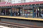
Kingsbridge, Bronx
Former towns in New York CityKingsbridge, BronxNeighborhoods in the BronxUse mdy dates from August 2018

Kingsbridge is a residential neighborhood in the northwest portion of the Bronx, New York City. Kingsbridge's boundaries are Manhattan College Parkway to the north, the Major Deegan Expressway or Bailey Avenue to the east, West 230th Street to the south, and Irwin Avenue to the west. The neighborhood is part of Bronx Community Board 8 and its ZIP Code is 10463. Kingsbridge is patrolled by the New York City Police Department's 50th Precinct.
Excerpt from the Wikipedia article Kingsbridge, Bronx (License: CC BY-SA 3.0, Authors, Images).Kingsbridge, Bronx
West 231st Street, New York The Bronx
Geographical coordinates (GPS) Address Nearby Places Show on map
Geographical coordinates (GPS)
| Latitude | Longitude |
|---|---|
| N 40.879 ° | E -73.905 ° |
Address
West 231st Street 200
10463 New York, The Bronx
New York, United States
Open on Google Maps


