Trent Lock
Canals in DerbyshireCommons category link is defined as the pagenameDerbyshire geography stubsGeographic coordinate listsLeicestershire geography stubs ... and 7 more
Lists of coordinatesNottinghamshire geography stubsRiver TrentStructures in DerbyshireTransport in LeicestershireTransport in NottinghamshireUse British English from September 2017

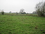
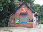
Trent Lock (otherwise Trentlock) is located south of Long Eaton, on the borders of Derbyshire, Leicestershire and Nottinghamshire in the United Kingdom. The area is a major canal navigation junction, where the River Soar and Erewash Canal can reach the Trent and Mersey Canal by way of the River Trent and adjacent Cranfleet Cut. Immediately to its north-east is Trent Junction, a similarly important five-way meeting point in the national railway system.
Excerpt from the Wikipedia article Trent Lock (License: CC BY-SA 3.0, Authors, Images).Trent Lock
Lock Lane, Erewash
Geographical coordinates (GPS) Address Nearby Places Show on map
Geographical coordinates (GPS)
| Latitude | Longitude |
|---|---|
| N 52.875 ° | E -1.2722222222222 ° |
Address
Lock Lane
NG10 2FY Erewash
England, United Kingdom
Open on Google Maps


