Upton, Peterborough
Cambridgeshire geography stubsCivil parishes in CambridgeshireGeography of PeterboroughUse British English from August 2017Villages in Cambridgeshire

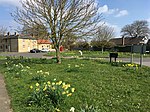
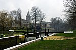
Upton is a village and civil parish in the Peterborough district, in the ceremonial county of Cambridgeshire, England. For electoral purposes it forms part of Glinton and Wittering ward in North West Cambridgeshire constituency. The population of the parish is included in the civil parish of Sutton. The Parish Church of St John the Baptist is a 12th-century Norman church with a north aisle rebuilt in 17th century. It was a chapel-of-ease and was built as a daughter church to St Kyneburgha's at Castor. The church is a Grade I listed building. It is set in the fields to the east of the village, 100 yards from the Roman King Street.
Excerpt from the Wikipedia article Upton, Peterborough (License: CC BY-SA 3.0, Authors, Images).Upton, Peterborough
Church Walk,
Geographical coordinates (GPS) Address Nearby Places Show on map
Geographical coordinates (GPS)
| Latitude | Longitude |
|---|---|
| N 52.5912 ° | E -0.3672 ° |
Address
Church Walk
Church Walk
PE6 7BD
England, United Kingdom
Open on Google Maps


