Buckden, Cambridgeshire
Buckden, CambridgeshireCivil parishes in CambridgeshireHuntingdonshireUse British English from June 2016Villages in Cambridgeshire

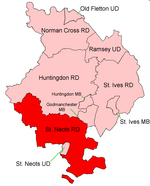
Buckden is a village and civil parish 3.7 miles (6.0 km) north of St Neots and 4 miles (6.4 km) south-west of Huntingdon, England. It includes the hamlets of Stirtloe and Hardwick. It lies in Huntingdonshire, a non-metropolitan district of Cambridgeshire and a historic county, close to three transport routes of past and present: the River Great Ouse, along its eastern boundary, the Great North Road that once crossed the village, but now bypasses it to the west, and the East Coast Mainline along the eastern side of the Great Ouse valley in the neighbouring parish of The Offords.
Excerpt from the Wikipedia article Buckden, Cambridgeshire (License: CC BY-SA 3.0, Authors, Images).Buckden, Cambridgeshire
Church Street, Huntingdonshire Buckden
Geographical coordinates (GPS) Address Nearby Places Show on map
Geographical coordinates (GPS)
| Latitude | Longitude |
|---|---|
| N 52.293446 ° | E -0.252419 ° |
Address
Church Street
PE19 5SS Huntingdonshire, Buckden
England, United Kingdom
Open on Google Maps


