Rancho Nueva Flandria
California ranchosRanchos of Yolo County, California
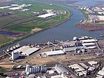
Rancho Nueva Flandria was a Mexican land grant in present-day Yolo County, California given in 1844 by Governor Manuel Micheltorena to Jan Lows de Swart (John Schwartz). The name means "New Flanders" in honor of Swart's native country. The grant extended along the west bank of the Sacramento River, from present-day Bryte south to Merritt Island, and encompassed present-day West Sacramento. The land claim was rejected as fraudulent in 1857.
Excerpt from the Wikipedia article Rancho Nueva Flandria (License: CC BY-SA 3.0, Authors).Rancho Nueva Flandria
Yolo Causeway,
Geographical coordinates (GPS) Address Nearby Places Show on map
Geographical coordinates (GPS)
| Latitude | Longitude |
|---|---|
| N 38.57 ° | E -121.62 ° |
Address
Yolo Causeway
Yolo Causeway
California, United States
Open on Google Maps


