Yolo Bypass

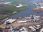
The Yolo Bypass is one of the two flood bypasses in California's Sacramento Valley located in Yolo and Solano Counties. Through a system of weirs, the bypass diverts floodwaters from the Sacramento River away from the state's capital city of Sacramento and other nearby riverside communities.During wet years, the bypass can be full of water. The main input to the bypass is through the passive Fremont Weir, where water spills from the Sacramento into the bypass if it reaches the 33.5 feet (10.2 m) crest. Downstream, the Sacramento Weir, just north of the city of West Sacramento, can also be opened to divert additional waters from the Sacramento if needed. From the west, Cache Creek drains into the bypass. The bypass itself runs south, parallel to the Sacramento, and drains into the Sacramento-San Joaquin Delta, a few kilometres north of Rio Vista. The bypass is crossed by the Yolo Causeway, a long highway bridge on Interstate 80, linking West Sacramento and the city of Davis. To the north, Interstate 5 also crosses the bypass on the Elkhorn Causeway, east of the city of Woodland.
Excerpt from the Wikipedia article Yolo Bypass (License: CC BY-SA 3.0, Authors, Images).Yolo Bypass
Geographical coordinates (GPS) Address Nearby Places Show on map
Geographical coordinates (GPS)
| Latitude | Longitude |
|---|---|
| N 38.55 ° | E -121.6 ° |
Address
Yolo County (Yolo)
California, United States
Open on Google Maps


