place

Cima Palon

Military history of Italy during World War IMountains of ItalyMountains of VenetoMountains of the AlpsVicentine Alps
Monte Pasubio
Monte Pasubio

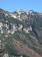
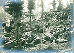
Cima Palon, also called Monte Pasubio, is the highest peak of the Pasubio group of Little Dolomites in Veneto, Italy. It has an elevation of 2,239 metres.The Pasubio plateau is one of the most relevant Little Dolomites massifs, and it held a high strategic role during the Great War (1914-1918), since it represented the last defensive position of the Venetian Plain. It was the site of fierce mine warfare on the Italian Front. In May 1916, after the Austro-Hungarian Strafexpedition, an Italian contingent was urgently transferred from the Isonzo Front and under the command of General Achille Papa, they stopped the Austro-Hungarian Army at Cima Palon.In 1917, a team of Italian miners built the Strada delle 52 Gallerie, the route of 52 tunnels, which leads from the base to the summit area of Monte Pasubio.

Excerpt from the Wikipedia article Cima Palon (License: CC BY-SA 3.0, Authors, Images).

Cima Palon
Galleria Papa, Trambileno

Geographical coordinates (GPS) Address Nearby Places
placeShow on map

Wikipedia: Cima PalonContinue reading on Wikipedia

Geographical coordinates (GPS)

Latitude Longitude
N 45.792013888889 ° E 11.176486111111 °
placeShow on map

Address

Galleria Papa

Galleria Papa
Trambileno
Trentino-Alto Adige/Südtirol, Italy
mapOpen on Google Maps

Monte Pasubio
Monte Pasubio
Share experience

Nearby Places

Rotzo Formation
Rotzo Formation

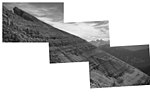
The Rotzo Formation (also known in older literature as the Noriglio Grey Limestone Formation) is a geological formation in Italy, dating to roughly between 192 and 186 million years ago and covering the Pliensbachian stage of the Jurassic Period in the Mesozoic Era. Has been traditionally classified as a Sinemurian-Pliensbachian Formation, but a large and detailed dataset of isotopic 13C and 87Sr/86Sr data, estimated the Rotzo Formation to span only over the Early Pliensbachian, bracketed between the Jamesoni-Davoei biozones, marked in the Loppio Oolitic Limestone–Rotzo Fm contact by a carbon isotope excursion onset similar to the Sinemu-Pliens boundary event, while the other sequences fit with the a warm phase that lasts until the Davoei biozone. The Rotzo Formation represented the Carbonate Platform, being located over the Trento Platform and surrounded by the Massone Oolite (marginal calcarenitic bodies), the Fanes Piccola Encrinite (condensed deposits and emerged lands), the Lombadian Basin Medolo Group and Belluno Basin Soverzene Formation (open marine), and finally towards the south, deep water deposits of the Adriatic Basin. The also Pliensbachian Aganane Formation of Morocco represents a regional equivalent, both in deposition and faunal content. Fossil prosauropod tracks have been reported from the formation. This formation was deposited within a tropical lagoon environment, similar to modern Bahamas which was protected by oolitic shoals and bars from the open deep sea located to the east (Belluno Basin) and towards the west (Lombardia Basin). It is characterized by a rich paleontological content. It is notable mostly thanks to its great amount of big aberrant bivalves, among which is the genus Lithiotis, described in the second half of the nineteenth century. The unusual shape of Lithiotis and Cochlearites shells, extremely elongated and narrow, characterized by a spoon-like body space placed in a high position, rarely preserved, seems to suggest their adaptation to soft and muddy bottoms with a high sedimentation rate. The Bellori outcrop displays about 20 m of limestones with intercalated clays and marls rich in organic matter and sometimes fossil wood (coal) and amber. The limestones are well stratified, with beds 10 cm to more than one metre thick, whereas the clayey levels range between 3 and 40 cm in thickness.