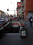
Gorla

Gorla (Italian pronunciation: [ˈɡɔrla]; Lombard: Gòrla, same pronunciation) is a district ("quartiere") of Milan, Italy. It is part of the Zone 2 administrative division, located north-east of the city centre. Before 1923, Gorla was an independent comune. The name "Gorla" is probably derived from the latin word gulula, meaning "little cleft".The district is traversed by Viale Monza, a major thoroughfare connecting Milan and Monza, as well as the Naviglio Martesana canal. The most prominent architectural feature of Gorla consists in a number of 19th Century villas that were built along the Naviglio Martesana and served as country residences for rich Milanese families.
Excerpt from the Wikipedia article Gorla (License: CC BY-SA 3.0, Authors, Images).Gorla
Piazza dei Piccoli Martiri, Milan Municipio 2
Geographical coordinates (GPS) Address Nearby Places Show on map
Geographical coordinates (GPS)
| Latitude | Longitude |
|---|---|
| N 45.5046 ° | E 9.2242 ° |
Address
Ossario Piccoli Martiri di Gorla
Piazza dei Piccoli Martiri
20127 Milan, Municipio 2
Lombardy, Italy
Open on Google Maps


