East Killara
Ku-ring-gai CouncilSuburbs of SydneySydney geography stubsUse Australian English from March 2014

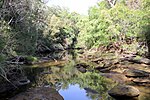
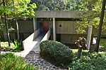
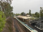
East Killara is a suburb on the Upper North Shore of Sydney in the state of New South Wales, Australia. East Killara is located 15 kilometres north of the Sydney Central Business District in the local government area of Ku-ring-gai Council. It is bordered by Garigal national park to the East and Eastern Arterial Rd/ Birdwood Ave to the west. Killara is a separate suburb to the south-west, which shares the postcode of 2071. East Killara is set in peaceful bushland. The main road is Koola Avenue which extends from Birdwood Avenue to Albany Crescent.
Excerpt from the Wikipedia article East Killara (License: CC BY-SA 3.0, Authors, Images).East Killara
Varrelbuscher Straße,
Geographical coordinates (GPS) Address Nearby Places Show on map
Geographical coordinates (GPS)
| Latitude | Longitude |
|---|---|
| N -33.75592 ° | E 151.17973 ° |
Address
Varrelbuscher Straße 2
49661
Niedersachsen, Deutschland
Open on Google Maps


