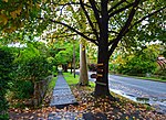
East Lindfield, New South Wales
Suburbs of SydneyUse Australian English from February 2015

East Lindfield is a suburb on the Upper North Shore of Sydney in the state of New South Wales, Australia. East Lindfield is located 13 kilometres north-west of the Sydney Central Business District in the local government area of Ku-ring-gai Council. Lindfield is a separate suburb to the west sharing the postcode of 2070.
Excerpt from the Wikipedia article East Lindfield, New South Wales (License: CC BY-SA 3.0, Authors, Images).East Lindfield, New South Wales
Woodlands Road, Sydney East Lindfield
Geographical coordinates (GPS) Address Nearby Places Show on map
Geographical coordinates (GPS)
| Latitude | Longitude |
|---|---|
| N -33.77274 ° | E 151.18726 ° |
Address
Woodlands Road
Woodlands Road
2070 Sydney, East Lindfield
New South Wales, Australia
Open on Google Maps


