place

Mianus River

Connecticut geography stubsConnecticut placenames of Native American originGeography of Stamford, ConnecticutGreenwich, ConnecticutHudson Valley, New York geography stubs
Long Island SoundNew York (state) river stubsNortheastern United States river stubsRivers of ConnecticutRivers of Fairfield County, ConnecticutRivers of New York (state)Rivers of Westchester County, New York
Dam on Mianus River in Mianus River Park near Old Mill Lane

The Mianus River is a 20.3-mile-long (32.7 km) river in Westchester County, New York, and Fairfield County, Connecticut, in the United States. It begins in the town of North Castle, New York (east of Armonk) in a series of ponds at about 600 feet (180 m) altitude. Flowing northeast into the town of Bedford, it abruptly turns south and passes through the Mianus River Gorge, a nature preserve, before entering Stamford, Connecticut, where it is dammed into the Mianus Reservoir, officially known as the Samuel J. Bargh Reservoir (256-foot (78 m) altitude) of the Greenwich Water Company. From there, it flows south through Stamford and Greenwich into Long Island Sound, at sea level. The river flows under the Mianus River Bridge, which is part of Interstate 95, U.S. Route 1, and the Mianus River Railroad Bridge which carries the New Haven Line of Metro-North Railroad. The Mianus flows through parks including the Mianus River State Park (straddling the Stamford/Greenwich border) and Mianus Glen, just to the north in Stamford, as well as Newman Mills Park in North Stamford. The Mianus Fault runs near the river, pushing rock on the east side down, relative to the west side.Mianus is a corruption of Mayanno, an Indian chieftain. Mianus has frequently been noted on lists of unusual place names.

Excerpt from the Wikipedia article Mianus River (License: CC BY-SA 3.0, Authors, Images).

Mianus River
Governor John Davis Lodge Turnpike,

Geographical coordinates (GPS) Address Nearby Places
placeShow on map

Wikipedia: Mianus RiverContinue reading on Wikipedia

Geographical coordinates (GPS)

Latitude Longitude
N 41.039 ° E -73.59 °
placeShow on map

Address

Governor John Davis Lodge Turnpike
06878
Connecticut, United States
mapOpen on Google Maps

Dam on Mianus River in Mianus River Park near Old Mill Lane
Share experience

Nearby Places

Mianus River Railroad Bridge

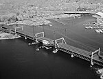
The Mianus River Railroad Bridge, also known as the Cos Cob Bridge, is a bascule drawbridge built in 1904 over the Mianus River, in Greenwich, Connecticut. It was listed on the National Register of Historic Places in 1987. The bridge carries the Northeast Corridor, the busiest rail line in the United States, both in terms of ridership and service frequency. It is operated by the Metro-North Railroad, successor to Conrail, Penn Central, and the New York, New Haven and Hartford Railroad, which erected it, and is owned by the Connecticut Department of Transportation. It is a rolling lift type moveable bridge, and was prefabricated by the American Bridge Company, to replace a previous unsafe bridge on the site. It has a total length of 1,059 feet (323 m), divided into 11 spans. Seven of these are deck truss spans, while the others are deck girder spans, all set on stone abutments. The main movable span is 107 feet (33 m) long; four of the truss spans are 120 feet (37 m) in length. It is one of eight moveable bridges on the Northeast Corridor through Connecticut surveyed in one multiple property study in 1986. The eight bridges from west to east are: this Mianus River Railroad Bridge, at Cos Cob, built in 1904; Norwalk River Railroad Bridge at South Norwalk, 1896; Saugatuck River Railroad Bridge at Westport, 1905; Pequonnock River Railroad Bridge at Bridgeport, 1902; Housatonic River Railroad Bridge, at Devon, 1905; Connecticut River Railroad Bridge, Old Saybrook-Old Lyme, 1907; Niantic River Bridge, East Lyme-Waterford, 1907; and Thames River Bridge (Amtrak), Groton, built in 1919. The Pequonnock River bridge—also on Metro-North's New Haven Line, as are the Norwalk, Westport, and Devon bridges—has since been replaced.

Strickland Road Historic District

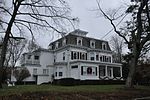
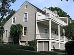
The Strickland Road Historic District of Greenwich, Connecticut is a 9-acre (3.6 ha) historic district that was listed on the U.S. National Register of Historic Places in 1990. The district extends along Strickland Road in the Cos Cob section of Greenwich, between its junction River Road in the south, to just north of its junction with Loughlin Road in the north. It represents a well-preserved cross-section of residential architecture dating coverint a 200-year period, from about 1740 to 1934. It includes the c. 1730 Bush-Holley House, a historic house museum which is a National Historic Landmark for it role in the Cos Cob art colony. There are 28 primary contributing buildings in the district. Most of the buildings are wood-frame structures between one and three stories in height; the notable exceptions are two of the later houses, which are Tudor Revival in style and have brick and stucco exteriors.The Cos Cob area was settled in the 17th century as a colonial maritime community, at first by Dutch settlers (as part of New Netherland) and later by English settlers. The Strickland Road area was known as the Lower Landing, and flourished in the 18th century, particularly through the efforts of David Bush, the Dutch builder of the Bush-Holley House. It was primarily a transportation center, with packet boats serving other area ports, and some of the finer houses on Strickland Road were built by sea captains. The area declined in importance after the packet boats were supplanted by the railroad in the mid-19th century, and became a residential enclave. Its last major industrial site, a tidal grist mill, burned in 1899. Most of the buildings in the district date to the early 20th century, in the Bungalow and Tudor Revival styles popular at that time.