Filton Abbey Wood railway station

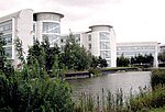
Filton Abbey Wood railway station serves the town of Filton in South Gloucestershire, England. It is 4.4 miles (7.1 km) from Bristol Temple Meads. There are four platforms but minimal facilities. The station is managed by Great Western Railway that operates all services. The general service level is eight trains per hour - two to South Wales, two to Bristol Parkway, two toward Weston-super-Mare and two toward Westbury. Filton Abbey Wood is the third station on the site. The first station, Filton, was opened in 1863 by the Bristol and South Wales Union Railway. The station had a single platform, with a second added in 1886 to cope with traffic from the Severn Tunnel. The station was closed in 1903, replaced by a new station, Filton Junction, 0.15 miles (0.24 km) further north, which was built at the junction with the newly constructed Badminton Line from Wootton Bassett Junction. The new station had four platforms, each with waiting rooms and large canopies. Services at Filton Junction declined in the second half of the twentieth century, with the station buildings and Badminton Line platforms demolished in 1976. The station was closed completely in September 1996, replaced by the current station, Filton Abbey Wood. This was built 0.3 miles (0.48 km) south of the original station, adjacent to the new Ministry of Defence office development of MoD Abbey Wood, which was opened in 1996. The station was built with two platforms, but a third was added in 2004 and a fourth in 2018. The line through Filton Abbey Wood is not electrified. Platform 4 was completed in 2018 as part of the Filton Bank four-tracking project, allowing increased services between Bristol Parkway and Bristol Temple Meads.
Excerpt from the Wikipedia article Filton Abbey Wood railway station (License: CC BY-SA 3.0, Authors, Images).Filton Abbey Wood railway station
Emma-Chris Way,
Geographical coordinates (GPS) Address Nearby Places Show on map
Geographical coordinates (GPS)
| Latitude | Longitude |
|---|---|
| N 51.5049 ° | E -2.5624 ° |
Address
Emma-Chris Way
Emma-Chris Way
, Northville
England, United Kingdom
Open on Google Maps


