Bilgola Plateau, New South Wales

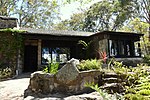
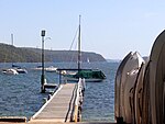
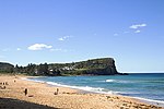
Bilgola Plateau is a suburb in Sydney, in the state of New South Wales, Australia.The suburb is mainly residential, with two small rows of shops, a small park and a primary school located on the top of the plateau. Bilgola Beach on the eastern side features a surf club and kiosk. Rising to an elevation of 150m above sea level, the suburb has views of the beach and the ocean on the eastern side, and views of the body of water, Pittwater on the western side. To the north are the suburbs of Avalon Beach, Whale Beach, and Palm Beach, with Careel Bay being a minor bay in between the latter two, as well as Clareville to the North West. To the south are Newport, Mona Vale and Narrabeen. The plateau was previously named Mount Loftus, after governor of NSW Lord Augustus Loftus. Given its modest elevation, designating it as a plateau is more appropriate, and is now named for the Aboriginal derived name of Bilgola (derived from the local aboriginal language meaning "swirling water"), likely describing Bilgola Beach to the east.
Excerpt from the Wikipedia article Bilgola Plateau, New South Wales (License: CC BY-SA 3.0, Authors, Images).Bilgola Plateau, New South Wales
Hilltop Road, Sydney Avalon Beach
Geographical coordinates (GPS) Address Nearby Places Show on map
Geographical coordinates (GPS)
| Latitude | Longitude |
|---|---|
| N -33.633333333333 ° | E 151.31666666667 ° |
Address
Hilltop Road 51
2107 Sydney, Avalon Beach
New South Wales, Australia
Open on Google Maps


