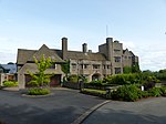
Forests of Mara and Mondrem

The Forests of Mara and Mondrem were adjacent medieval forests in Cheshire, England, which in the 11th century extended to over 60 square miles (160 km2), stretching from the Mersey in the north almost to Nantwich in the south, and from the Gowy in the west to the Weaver in the east. Mara and Mondrem were a hunting forest of the Norman Earls of Chester, established soon after 1071 by the first earl, Hugh d'Avranches. They might earlier have been an Anglo-Saxon hunting forest. Game included wild boar, and red, fallow and roe deer. After the earldom lapsed in 1237, the forest rights passed to the Crown, with the monarch's heir being given the title of Earl of Chester. Edward I and James I both hunted in the forests. Clearance for agricultural use began to be permitted after 1215, and by the mid-14th century, large areas of the Forest of Mondrem had been cleared. Deer hunting still continued within the remaining forest in the 17th century, and the forest was not formally disafforested, or removed from forest law, until 1812. The modern Delamere Forest is the remnant of the medieval forests, but little ancient woodland survives.
Excerpt from the Wikipedia article Forests of Mara and Mondrem (License: CC BY-SA 3.0, Authors, Images).Forests of Mara and Mondrem
Middlewich Road,
Geographical coordinates (GPS) Address Nearby Places Show on map
Geographical coordinates (GPS)
| Latitude | Longitude |
|---|---|
| N 53.205 ° | E -2.667 ° |
Address
Middlewich Road
Middlewich Road
CW6 9EH , Delamere and Oakmere
England, United Kingdom
Open on Google Maps


