River Tamar

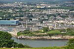
The Tamar (; Cornish: Dowr Tamar) is a river in south west England that forms most of the border between Devon (to the east) and Cornwall (to the west). A part of the Tamar Valley is a World Heritage Site due to its historic mining activities. The Tamar's source is less than 6 km (3.7 mi) from the north Cornish coast, but it flows southward across the peninsula to the south coast. The total length of the river is 61 miles (98 km). At its mouth, the Tamar flows into the Hamoaze before entering Plymouth Sound, a bay in the English Channel. Tributaries of the river include the rivers Inny, Ottery, Kensey and Lynher (or St Germans River) on the Cornish side and the Deer and Tavy on the Devon side. The name Tamar (or Tamare) was mentioned by Ptolemy in the 2nd century AD in his Geography. The name is said to mean "great water". The Tamar is one of several British rivers whose ancient name is assumed by some to be derived from a prehistoric river word apparently meaning "dark flowing" and which it shares with the River Thames.The seventh-century Ravenna Cosmography mentions a Roman settlement named Tamaris, but it is unclear to which of those towns along the Tamar this refers. Plymouth, Launceston and the Roman fort at Calstock have been variously suggested.
Excerpt from the Wikipedia article River Tamar (License: CC BY-SA 3.0, Authors, Images).River Tamar
Admiralty Road, Plymouth Stonehouse
Geographical coordinates (GPS) Address Nearby Places Show on map
Geographical coordinates (GPS)
| Latitude | Longitude |
|---|---|
| N 50.358333333333 ° | E -4.1666666666667 ° |
Address
Admiralty Road
PL1 3RS Plymouth, Stonehouse
England, United Kingdom
Open on Google Maps


