place

Royal William Victualling Yard

Buildings and structures in Plymouth, DevonGrade II* listed buildings in DevonGrade II* listed fortsGrade I listed buildings in DevonGrade I listed forts
Industrial archaeological sites in DevonMilitary history of DevonRoyal NavyRoyal Navy bases in EnglandRoyal Navy shore establishments
The Basin and the Melville Block at Royal William Victualling Yard geograph.org.uk 917298

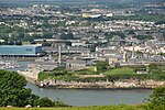
The Royal William Victualling Yard in Stonehouse, a suburb of Plymouth, England, was the major victualling depot of the Royal Navy and an important adjunct of Devonport Dockyard. It was designed by the architect Sir John Rennie and was named after King William IV. It was built between 1826 and 1835 and occupies a site of approximately 16 acres (65,000 m2) being half of Western Kings, north of Devil's Point. The Yard was released from the Ministry of Defence (MOD) in 1992 and subsequently passed to the Plymouth Development Corporation. Upon the Corporation's closure in 1999, the Yard was then passed to The South West Regional Development Agency (SWRDA) who funded and carried out the extensive c. £60m restoration of the structural fabric of the majority of principal buildings and infrastructure within the yard between 1999 and 2008. During this period the buildings were recategorised from Scheduled Monuments to Grade I/II listed buildings. Private sector development partners Urban Splash were then engaged to carry out the specialist conversion of the site into a mixed-use development. Described as the grandest of the royal victualling yards, 'in its externally largely unaltered state it remains today one of the most magnificent industrial monuments in the country'.

Excerpt from the Wikipedia article Royal William Victualling Yard (License: CC BY-SA 3.0, Authors, Images).

Royal William Victualling Yard
Admiralty Road, Plymouth Stonehouse

Geographical coordinates (GPS) Address Nearby Places
placeShow on map

Wikipedia: Royal William Victualling YardContinue reading on Wikipedia

Geographical coordinates (GPS)

Latitude Longitude
N 50.3617 ° E -4.16475 °
placeShow on map

Address

Admiralty Road
PL1 3RS Plymouth, Stonehouse
England, United Kingdom
mapOpen on Google Maps

The Basin and the Melville Block at Royal William Victualling Yard geograph.org.uk 917298
Share experience

Nearby Places

Western King's Redoubt

The Western King's Redoubt is an 18th and 19th-century artillery battery in Plymouth, Devonshire, England, upgraded as a result of the Royal Commission on the Defence of the United Kingdom of 1859. Part of an extensive scheme known as Palmerston Forts, after the prime minister who championed the scheme, it was built to defend the seaward approaches to the Hamoaze, as an element of the plan for the defence of the Royal Naval Dockyard at Devonport. In 1779, a pair of small forts or redoubts were constructed overlooking Firestone Bay in Plymouth Sound, known as Western and Eastern King's Redoubts. The western redoubt mounted twelve 18-pounder cannons. In 1861, a battery was built to mount nine guns, with a further seven guns in the older redoubt to the rear of the battery. By 1893 it mounted nine 64 Pounder Rifled Muzzle Loading Guns.By 1897 the battery was remodelled and a battery for seven 12 Pounder Quick Firing (QF) guns was built over the west flank and redoubt. By 1918 only four of these guns remained. In 1941 two positions were created for twin 6 pounder Quick Firing guns to provide rapid firing capability against enemy Motor Torpedo Boats (MTBs). These positions remained armed until the dissolution of coast artillery in 1956 when they were removed. Today the site is open and can be explored. The 12 Pounder Quick Firing gun positions survive intact and the positions for the twin 6 Pounder guns have been partly filled in but retain their overhead cover, designed as protection against air attack.