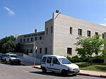
Al-Sumayriyya
1948 disestablishments in Mandatory PalestineArab villages depopulated during the 1948 Arab–Israeli WarArab villages depopulated prior to the 1948 Arab–Israeli WarDistrict of AcrePages with non-numeric formatnum arguments ... and 1 more
Wikipedia extended-confirmed-protected pages

Al-Sumayriyya (Arabic: السُميريه, Katasir in Canaanite times, Someleria during Crusader rule), was a Palestinian village located six kilometers north of Acre that was depopulated after it was captured by the Israel Defense Forces during the 1948 Arab-Israeli War. The ruins of the village are today in the outskirts of the Israeli moshav of Regba.
Excerpt from the Wikipedia article Al-Sumayriyya (License: CC BY-SA 3.0, Authors, Images).Al-Sumayriyya
Gdud 21, Mate Asher Regional Council
Geographical coordinates (GPS) Address Nearby Places Show on map
Geographical coordinates (GPS)
| Latitude | Longitude |
|---|---|
| N 32.972777777778 ° | E 35.093333333333 ° |
Address
גדוד 21
Gdud 21
2235813 Mate Asher Regional Council
North District, Israel
Open on Google Maps


