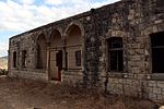
Suhmata
1948 disestablishments in IsraelArab villages depopulated during the 1948 Arab–Israeli WarDistrict of AcrePages with non-numeric formatnum argumentsWikipedia extended-confirmed-protected pages

Suhmata (Arabic: سحماتا), was a Palestinian village, located 25 kilometres (16 mi) northeast of Acre. It was depopulated by the Golani Brigade during the 1948 Arab-Israeli war.
Excerpt from the Wikipedia article Suhmata (License: CC BY-SA 3.0, Authors, Images).Suhmata
89, Maale Yosef Regional Council
Geographical coordinates (GPS) Address Nearby Places Show on map
Geographical coordinates (GPS)
| Latitude | Longitude |
|---|---|
| N 33.005277777778 ° | E 35.303888888889 ° |
Address
89
2405918 Maale Yosef Regional Council
North District, Israel
Open on Google Maps


