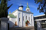
place

Unley, South Australia

Adelaide geography stubsPopulated places established in 1840Suburbs of AdelaideUse Australian English from August 2019
OIC unley duthy st shops

Unley is an inner-southern suburb of Adelaide, South Australia, within the City of Unley. The suburb is the home of the Sturt Football Club in the South Australian National Football League (SANFL). Unley neighbours Adelaide Park Lands, Fullarton, Hyde Park, Malvern, Parkside and Wayville. The boundaries of Unley are Greenhill Road (north), Unley Road, Maud Street and Windsor Street (east), Cremorne Street and Opey Avenue (south) and King William Road (west). Unley is the family name of the wife of Thomas Whistler, owner of land in Unley which was laid out around 1857.

Excerpt from the Wikipedia article Unley, South Australia (License: CC BY-SA 3.0, Authors, Images).

Unley, South Australia
King William Road, Adelaide Unley

Geographical coordinates (GPS) Address Nearby Places
placeShow on map

Wikipedia: Unley, South AustraliaContinue reading on Wikipedia

Geographical coordinates (GPS)

Latitude Longitude
N -34.95 ° E 138.6 °
placeShow on map

Address

Stop 4 King William Road - East side

King William Road
5061 Adelaide, Unley
South Australia, Australia
mapOpen on Google Maps

OIC unley duthy st shops
Share experience

Nearby Places

Unley Museum
Unley Museum

The Unley Museum is a local history museum in Unley, South Australia located at 80 Edmund Avenue in the former Unley Fire Station building, built in 1898. It was founded as a museum in 1971, and operated by the City of Unley. The museum with five gallery spaces has more than 12,000 photographs and objects, and has grown from donations of Unley people. The Unley Museum incorporates several display galleries, a research library, and conducts research into house histories and families of Unley. In 2012 The Unley Museum won the Museums and National Galleries Award MAGNA 2012 (Level 2), the nomination "Permanent Exhibition" for "Gorgeous Gardens". The judges described the project: "An engaging project, innovatively presented, well researched and visually appealing, with strong connections to a diversity of community members through a subject to which all can relate positively."In 2016 The Unley Museum won the Museums and National Galleries Award MAGNA 2016 (Level 1), the nomination "Permanent Exhibition or Gallery Fitout" for the best permanent exhibition "200 Years of Change". This permanent exhibition tells about two centuries of history from the Kaurna people to Unley today. The interactive exhibition includes displays, photographs, videos and objects that could be touched and used in order to discover exciting stories about the history of Unley.In 2017 the Unley Museum won the Museums and National Galleries Award MAGNA 2017 (Level 1), the nomination "Permanent Exhibition or Gallery Fitout" for the exhibition "Terrible Tales of Unley". The exhibition explores the stories from Unley's past related to mystery, murder, and fire. The interactive displays include activities to keep visitors entertained in order to solve an Unley mystery.In 2019 the Unley Museum was awarded an Adelaide Fringe Festival Award for the contemporary art exhibition. "Things of Nature". A contemporary art exhibition explores the significance of nature.

Adelaide Plains
Adelaide Plains

The Adelaide Plains (Kaurna name Tarndanya) is a plain in South Australia lying between the coast (Gulf St Vincent) on the west and the Mount Lofty Ranges on the east. The southernmost tip of the plain is in the southern seaside suburbs of Adelaide around Brighton at the foot of the O'Halloran Hill escarpment with the south Hummocks Range and Wakefield River roughly approximating the northern boundary.Traditionally entirely occupied by the Kaurna (indigenous) people, the Adelaide Plains are crossed by a number of rivers and creeks, but several dry up during summer. The rivers (from south to north) include: the Onkaparinga/Ngangki, Sturt/Warri Torrens/Karra Wirra, Little Para, Gawler, Light/Yarralinka and Wakefield/Undalya. The plains are generally fertile with annual rainfall of about 460 millimetres (18 in) per year. The plain can be roughly divided into three parts. The southern area is now covered by the city of Adelaide, the capital of South Australia. The central area is considered the breadbasket of South Australia with many market gardens and wineries, particularly around the towns of Virginia and Angle Vale. The northern area is predominantly used for growing cereal grains such as wheat, barley, and canola, and farming sheep. Usage of the term Adelaide Plains frequently refers to a central and non-metropolitan subset of the plain. This is evidenced by the Adelaide Plains Council local government area which occupies 932 square kilometres (360 sq mi) from the Gawler river in the south to Wild Horse Plains, Long Plains and Grace Plains north of Dublin and Mallala.