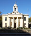
London Borough of Camden

The London Borough of Camden () is a London borough in Inner London. Camden Town Hall, on Euston Road, lies 1.4 mi (2.3 km) north of Charing Cross. The borough was established on 1 April 1965 from the area of the former boroughs of Hampstead, Holborn, and St Pancras — which together, prior to that date, had comprised part of the historical County of London. The cultural and commercial land uses in the south contrasts with the bustling mixed-use districts such as Camden Town and Kentish Town in the centre and leafy residential areas around Hampstead Heath in the north. Well known attractions include The British Museum, The British Library, the famous views from Parliament Hill, the London Zoo, the BT Tower, The Roundhouse and Camden Market. In 2019 it was estimated to have a population of 270,000. The local authority is Camden London Borough Council.
Excerpt from the Wikipedia article London Borough of Camden (License: CC BY-SA 3.0, Authors, Images).London Borough of Camden
Charlbert Street, City of Westminster St. John's Wood
Geographical coordinates (GPS) Address Nearby Places Show on map
Geographical coordinates (GPS)
| Latitude | Longitude |
|---|---|
| N 51.533333333333 ° | E -0.16666666666667 ° |
Address
Charlbert Street 12
NW8 6LS City of Westminster, St. John's Wood
England, United Kingdom
Open on Google Maps


