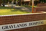
Karrakatta, Western Australia
Karrakatta, Western AustraliaPerth, Western Australia geography stubsSuburbs in the City of NedlandsSuburbs of Perth, Western AustraliaUse Australian English from March 2014

Karrakatta is a suburb of Perth, Western Australia, located within the City of Nedlands and 7 km west of the central business district. Its postcode is 6010. Karrakatta is composed of two distinct areas, due to the Fremantle railway line passing through the suburb. On the south side is Karrakatta Cemetery, which began service in 1899, with a small industrial area occupied by monument builders, associated companies and the depot for City of Nedlands. The other area north of the railway line and Karrakatta railway station is occupied by the Australian Defence Force's Irwin Army Barracks.
Excerpt from the Wikipedia article Karrakatta, Western Australia (License: CC BY-SA 3.0, Authors, Images).Karrakatta, Western Australia
Forrest Drive,
Geographical coordinates (GPS) Address Nearby Places Show on map
Geographical coordinates (GPS)
| Latitude | Longitude |
|---|---|
| N -31.968 ° | E 115.801 ° |
Address
Forrest Drive
Forrest Drive
6009 , Karrakatta
Western Australia, Australia
Open on Google Maps


