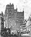
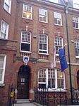
Westminster St Margaret and St John

St Margaret was an ancient parish in the City and Liberty of Westminster and the county of Middlesex. It included the core of modern Westminster, including the Palace of Westminster and the area around, but not including Westminster Abbey. It was divided into St Margaret's and St John's in 1727, to coincide with the building of the Church of St John the Evangelist, constructed by the Commission for Building Fifty New Churches in Smith Square to meet the demands of the growing population, but there continued to be a single vestry for the parishes of St Margaret and St John. This was reformed in 1855 by the Metropolis Management Act, and the two parishes formed the Westminster District until 1887. St Margaret and St John became part of the County of London in 1889. The vestry was abolished in 1900, to be replaced by Westminster City Council, but St Margaret and St John continued to have a nominal existence until 1922.
Excerpt from the Wikipedia article Westminster St Margaret and St John (License: CC BY-SA 3.0, Authors, Images).Westminster St Margaret and St John
Broadway, London Millbank
Geographical coordinates (GPS) Address Nearby Places Show on map
Geographical coordinates (GPS)
| Latitude | Longitude |
|---|---|
| N 51.4995 ° | E -0.1333 ° |
Address
55 Broadway
Broadway 55
SW1H 0AZ London, Millbank
England, United Kingdom
Open on Google Maps


