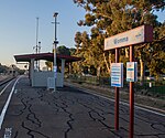
Davoren Park
Adelaide geography stubsSuburbs of AdelaideUse Australian English from August 2019
Davoren Park is a suburb at the northern extent of the Adelaide metropolitan area, South Australia in the City of Playford. The suburb was formed as part of a merger between Elizabeth Field and the northern part of Elizabeth West on 11 November 1993. It is named after the Davoren family, who were early pioneers of the area.The Playford North Urban Renewal project to expand and upgrade the area commenced in 2007 and is expected to take 10–15 years. The project focuses on the Peachey Belt (an unofficial designation roughly comprising Davoren Park, Smithfield and Smithfield Plains), which has been identified as a disadvantaged area.
Excerpt from the Wikipedia article Davoren Park (License: CC BY-SA 3.0, Authors).Davoren Park
Peachey Road, Adelaide Davoren Park
Geographical coordinates (GPS) Address Nearby Places Show on map
Geographical coordinates (GPS)
| Latitude | Longitude |
|---|---|
| N -34.691388888889 ° | E 138.66805555556 ° |
Address
Peachey Road
Peachey Road
5113 Adelaide, Davoren Park
South Australia, Australia
Open on Google Maps


