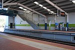
Woodvale, Western Australia

Woodvale is a suburb of Perth, Western Australia, located within the City of Joondalup and the City of Wanneroo. At the 2016 census Woodvale had a population of 9,276.Woodvale is bounded to the south by Whitfords Avenue, to the west by the Mitchell Freeway, to the north by Ocean Reef Road and to the east by Wanneroo Road. Trappers Drive runs through Woodvale, from Whitfords Avenue to Ocean Reef Road. The area within and around Woodvale was primarily rural until the late 1970s. Residential development began in 1979 and was completed by 1995 with the release of the Woodvale Waters housing estate. No farming properties remain in Woodvale. Many immigrants have settled in Woodvale, with 21.2% of residents born in the British Isles and 3.1% born in South Africa, in both cases twice the Western Australian average and four times the Australian average.
Excerpt from the Wikipedia article Woodvale, Western Australia (License: CC BY-SA 3.0, Authors, Images).Woodvale, Western Australia
Whitfords Avenue, Joondalup Kingsley
Geographical coordinates (GPS) Address Nearby Places Show on map
Geographical coordinates (GPS)
| Latitude | Longitude |
|---|---|
| N -31.799 ° | E 115.784 ° |
Address
Whitfords Train Station Parking
Whitfords Avenue
6026 Joondalup, Kingsley
Western Australia, Australia
Open on Google Maps


