Bluemont, Virginia

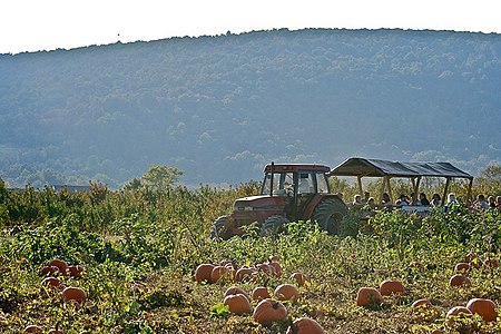
Bluemont is an unincorporated village in Loudoun County, Virginia located at the eastern base of Snickers Gap in the Blue Ridge Mountains. The village's center is located along Snickersville Turnpike (Virginia Route 734), 4 miles (6.4 km) west of the incorporated town of Round Hill. The village borders Virginia's fox hunting country and is within 1 mile (1.6 km) of the Appalachian Trail and the Bears Den and Raven Rocks formations in the Blue Ridge.Originally named Snickersville, the village renamed itself to Bluemont to help it attract visitors from Washington, D.C. when a predecessor of the Washington and Old Dominion Railroad extended its line westward from Round Hill in 1900. As of 2010, the Bluemont postal area had a population of 2,834. At 700 feet (210 m), it is the highest community in Loudoun County. Every fall it is home to the Bluemont Fair. A nearby landmark is Mount Weather, an operations and training facility above ground for the Federal Emergency Management Agency and is rumored to contain an underground facility designed to house or replace the U.S. government in the event that it is destroyed in an emergency (such as nuclear warfare).
Excerpt from the Wikipedia article Bluemont, Virginia (License: CC BY-SA 3.0, Authors, Images).Bluemont, Virginia
Snickersville Turnpike,
Geographical coordinates (GPS) Address Nearby Places Show on map
Geographical coordinates (GPS)
| Latitude | Longitude |
|---|---|
| N 39.110748 ° | E -77.833376 ° |
Address
Snickersville Turnpike 33735
20135
Virginia, United States
Open on Google Maps


