place

Rotterdam

1340 establishments in EuropeCities in the NetherlandsMunicipalities of South HollandPopulated places in South HollandPort cities and towns in the Netherlands
Port cities and towns of the North SeaRotterdam
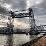
Erasmusbrug seen from Euromast

Rotterdam ( ROT-ər-dam, UK also ROT-ər-DAM, Dutch: [ˌrɔtərˈdɑm] (listen)) is the second largest city and municipality in the Netherlands. It is in the province of South Holland, at the mouth of the Nieuwe Maas channel leading into the Rhine–Meuse–Scheldt delta at the North Sea. Its history goes back to 1270, when a dam was constructed in the Rotte. In 1340, Rotterdam was granted city rights by William IV, Count of Holland. The Rotterdam–The Hague metropolitan area, with a population of approximately 2.7 million, is the 10th-largest in the European Union and the most populous in the country. A major logistic and economic centre, Rotterdam is Europe's largest seaport. In 2020, it had a population of 651,446 and is home to over 180 nationalities. Rotterdam is known for its university, riverside setting, lively cultural life, maritime heritage and modern architecture. The near-complete destruction of the city centre in the World War II Rotterdam Blitz has resulted in a varied architectural landscape, including skyscrapers designed by architects such as Rem Koolhaas, Piet Blom and Ben van Berkel.The Rhine, Meuse and Scheldt give waterway access into the heart of Western Europe, including the highly industrialized Ruhr. The extensive distribution system including rail, roads, and waterways have earned Rotterdam the nicknames "Gateway to Europe" and "Gateway to the World".

Excerpt from the Wikipedia article Rotterdam (License: CC BY-SA 3.0, Authors, Images).

Rotterdam
Maaskade, Rotterdam Feijenoord

Geographical coordinates (GPS) Address Nearby Places
placeShow on map

Wikipedia: RotterdamContinue reading on Wikipedia

Geographical coordinates (GPS)

Latitude Longitude
N 51.916666666667 ° E 4.5 °
placeShow on map

Address

Maaskade 33
3071 NB Rotterdam, Feijenoord
South Holland, Netherlands
mapOpen on Google Maps

Erasmusbrug seen from Euromast
Share experience

Nearby Places

Marine memorial
Marine memorial

The Marine memorial (Dutch: Mariniersmonument) is a war memorial on Oostplein in Rotterdam, Netherlands. It commemorates and thanks the Netherlands Marine Corps who fought hard for the city in the Battle of the Netherlands.The monument, a bronze statue of a marine, was made by Titus Leeser and was unveiled by Prince Bernhard on 5 July 1963. It stands on Oostplein, directly opposite the site of the former marines' barracks, which was bombed away in the May days of 1940. The barracks were located here from 1869 to 1940 in the former arsenal of the Admiralty of Rotterdam. Above the nearby underground entrance is the preserved side gate of the barracks. The wall surrounding the memorial also lists other achievements in the history of the Marine Corps, such as the four-day naval battle at Chatham in 1666, the Dutch East Indies, Korea, Cambodia and Uruzgan.According to Bram Grisnigt, around 30 Engelandvaarders served in the Marine Corps. These included Marines involved in the defence of the Maas bridges in Rotterdam during the May Days in 1940. From England, a number of Engelandvaarders/marines were sent to the United States to be further trained together with 450 Dutch marines to be deployed later in the war against Japan. Some of them were sent back to England to reinforce the Princess Irene Brigade, which landed at Arromanches on 8 August. Before the Dutch marines were deployed against Japan, Japan capitulated. The marines then went to the Dutch East Indies.At the celebration of the 50th anniversary of the marines' monument on 4 July 2013, former Marine Ben Schierboom was present. He was the model for the monument at the time. The anniversary marked the conclusion of the (extended) anniversary year of the Rotterdam and the Marines Foundation.