San Ángel

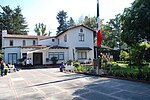
San Ángel is a colonia or neighborhood of Mexico City, located in the southwest in Álvaro Obregón borough. Historically, it was a rural community, called Tenanitla in the pre-Hispanic period. Its current name is derived from the El Carmen monastery school called San Ángel Mártir. San Ángel remained a rural community, centered on the monastery until the 19th and 20th centuries, when the monastery was closed and when the area joined urban sprawl of Mexico City. However, the area still contains many of its former historic buildings and El Carmen is one of the most visited museums in the city. It is also home to an annual flower fair called the Feria de las Flores, held since 1856. In 1934, San Ángel was declared as a Pueblo Típico Pintoresco (Picturesque Typical Town); in 1987, due to presidential order, it was declared historical monument zone.
Excerpt from the Wikipedia article San Ángel (License: CC BY-SA 3.0, Authors, Images).San Ángel
Avenida Insurgentes Sur, Santa Fe Álvaro Obregón
Geographical coordinates (GPS) Address Nearby Places Show on map
 Continue reading on Wikipedia
 Geographical coordinates (GPS)
| Latitude | Longitude |
|---|---|
| N 19.347 ° | E -99.187 ° |
Address
Avenida Insurgentes Sur
01000 Santa Fe, Álvaro Obregón
Mexico
Open on Google Maps