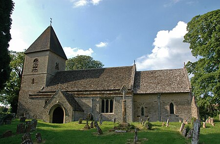
Fritwell

Fritwell is a village and civil parish about 5+1⁄2 miles (9 km) northwest of Bicester in Oxfordshire. The 2011 Census recorded the parish's population as 736.The parish's southern boundary is a stream that flows eastwards through Fewcott and past the villages of Fringford and Godington before entering Buckinghamshire where it becomes part of Padbury Brook, a tributary of the Great Ouse. The northeastern boundary of Fritwell parish is the main road between Bicester and Banbury. On other sides the parish is bounded by field boundaries. The Portway, a road that predates the Roman conquest of Britain, runs north–south parallel with the River Cherwell and passes through the western part of the parish. The village's toponym is derived from Fyrht-wielle or Fyrht-welle, which is Old English for a wishing well.
Excerpt from the Wikipedia article Fritwell (License: CC BY-SA 3.0, Authors, Images).Fritwell
East Street, Cherwell District
Geographical coordinates (GPS) Address Nearby Places Show on map
Geographical coordinates (GPS)
| Latitude | Longitude |
|---|---|
| N 51.96 ° | E -1.233 ° |
Address
East Street
East Street
OX27 7AF Cherwell District
England, United Kingdom
Open on Google Maps


