place

Dover Castle

Anthony Salvin buildingsCastles in KentEnglish Heritage sites in KentForts in Dover, KentGrade I listed buildings in Kent
Grade I listed castlesHistory museums in KentInvasions of EnglandMilitary and war museums in EnglandMilitary history of Dover, KentNapoleon's planned invasion of the United KingdomNapoleonic war forts in EnglandNorman conquest of EnglandPrincess of Wales's Royal RegimentScheduled monuments in KentTourist attractions in KentUse British English from June 2015World War II museums in the United Kingdom
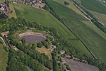
1 dover castle aerial panorama 2017

Dover Castle is a medieval castle in Dover, Kent, England and is Grade I listed. It was founded in the 11th century and has been described as the "Key to England" due to its defensive significance throughout history. Some writers say it is the largest castle in England, a title also claimed by Windsor Castle.

Excerpt from the Wikipedia article Dover Castle (License: CC BY-SA 3.0, Authors, Images).

Dover Castle
Castle Hill Road,

Geographical coordinates (GPS) Address Nearby Places
placeShow on map

Wikipedia: Dover CastleContinue reading on Wikipedia

Geographical coordinates (GPS)

Latitude Longitude
N 51.1297 ° E 1.3214 °
placeShow on map

Address

The Great Tower

Castle Hill Road
CT16 1HU , Tower Hamlets
England, United Kingdom
mapOpen on Google Maps

1 dover castle aerial panorama 2017
Share experience

Nearby Places

Fort Burgoyne
Fort Burgoyne

Fort Burgoyne, originally known as Castle Hill Fort, was built in the 1860s as one of the Palmerston forts around Dover in southeast England. It was built to a polygonal system with detached eastern and western redoubts, to guard the high ground northeast of the strategic port of Dover, just north of Dover Castle. The fort is named after the 19th century Field Marshal Sir John Fox Burgoyne, Inspector-General of Fortifications and son of the John Burgoyne who fought in the American Revolutionary War. After the First World War Fort Burgoyne was used as a military depot or store for Connaught Barracks. Until recently the central part of the fort was still owned by the Ministry of Defence, forming part of the Connaught Barracks site, which is now being redeveloped for housing.In 2014, Fort Burgoyne and a total of 42 Hectares of land was acquired by the Land Trust. Since acquiring the site the Trust has spent over £2.5 million on priority works (informed by a Coastal Revival Fund grant aided condition survey) to stabilise the site together with transforming the West Wing Battery of the site from condition of derelict buildings and structures lost in woodland to an informal recreation space for the community opened in 2023. As part of the Trust's long term aspiration to see the Fort become a vibrant business and community space in 2023 a project was completed providing opportunities for businesses to become the first tenants on site.

River Dour
River Dour

The River Dour is a chalk stream in the county of Kent, England. It flows from the villages of Temple Ewell and River between which is a neighbourhood served by a railway station, Kearsney. It is roughly 4 miles (6.4 km) long. It originally had a wide estuary on the site of modern Dover, although today it flows into the Dover Harbour through a culvert. The estuary was a natural harbour for the Bronze Age settlers and traders in the area. The remains of a Bronze Age seagoing boat (from 3,500 years ago), known as the Dover Bronze Age Boat, were found in 1992, and it can be seen in Dover Museum. The Dour Estuary was then used as a port for the Roman town, as a natural harbour for the Roman fleet. This silted up in the medieval period, necessitating the construction of various artificial harbours for Dover instead.The river has been used since AD 762 to power various watermills along its route. These included eight corn mills and five paper mills. Buckland Mill near Buckland Bridge was one of the earliest corn mills, but has since been converted into flats. Crabble Mill is now a fully restored corn mill and museum, and the Old Mill in Kearsney is now a private house, the others have been converted for various uses. Other industries on the river included iron foundries, saw mills (demolished) and a tannery (also converted).Kearsney, Kent and Kearsney Abbey (a former Grand House) is also beside the River. The River Dour Trail is a new walking trail (set up by the White Cliffs Countryside Project). It follows the Dour from Temple Ewell to Wellington Dock on the seafront. The trail is about 4 miles (6 km) long and takes 2.5 hours to walk fully.