place

Port Hacking

Bays of New South WalesGeography of SydneyPorts and harbours of New South WalesUse Australian English from July 2011
Port Hacking Estuary aerial

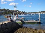
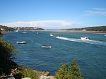
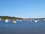
Port Hacking Estuary (Aboriginal Tharawal language: Deeban), an open youthful tide dominated, drowned valley estuary, is located in southern Sydney, New South Wales, Australia approximately 30 kilometres (19 mi) south of Sydney central business district. Port Hacking has its source in the upper reaches of the Hacking River south of Helensburgh, and several smaller creeks, including South West Arm, Bundeena Creek and The Basin and flows generally to the east before reaching its mouth, the Tasman Sea, south of Cronulla and north–east of Bundeena. Its tidal effect is terminated at the weir at Audley, in the Royal National Park. The lower estuary features a substantial marine delta, which over time has prograded upstream. There is also a substantial fluvial (riverine delta) of the Hacking River at Grays Point. The two deltas are separated by a deep basin. The total catchment area of Port Hacking is approximately 165 square kilometres (64 sq mi) and the area surrounding the estuary is generally managed by Sutherland Shire Council. While the area to the north of Port Hacking is urbanised, the area to the south is relatively pristine and forms the northern boundary of the Royal National Park. The land adjacent to Port Hacking was occupied for many thousands of years by the Tharawal and Eora, both Aboriginal peoples, and their associated clans. They used the bay as an important source of food and a place for trade.

Excerpt from the Wikipedia article Port Hacking (License: CC BY-SA 3.0, Authors, Images).

Port Hacking
Goobarah Road, Sydney Burraneer

Geographical coordinates (GPS) Address Nearby Places
placeShow on map

Wikipedia: Port HackingContinue reading on Wikipedia

Geographical coordinates (GPS)

Latitude Longitude
N -34.065277777778 ° E 151.13472222222 °
placeShow on map

Address

Goobarah Road

Goobarah Road
2230 Sydney, Burraneer
New South Wales, Australia
mapOpen on Google Maps

Port Hacking Estuary aerial
Share experience

Nearby Places

Cronulla Fisheries Centre

The Cronulla Fisheries Centre or Cronulla Fisheries Research Centre is a heritage-listed former fisheries research centre and now public reserve and marine rescue base located at the Southern end of Nicholson Parade, Cronulla, Sydney, New South Wales, Australia. It was built from 1904. It is also known as The Cronulla Fisheries Centre and Hungry Point Reserve; NSW Fisheries Research Institute; CSIRO Fisheries Division and the CSIRO Division of Fisheries & Oceanography. The property is owned by the NSW Department of Primary Industries, a department of the Government of New South Wales. The site has heritage listed buildings and several Australian Aboriginal sites. It was added to the New South Wales State Heritage Register on 2 April 1999.Following a long history of internationally recognised research, in 2011 a decision was made by the Government of New South Wales to decentralise the Centre's functions and staff to regional centres at Coffs Harbour, Port Stephens and Nowra. The decision created a degree of controversy as it was announced without any staff consultation, or a cost-benefit analysis. A Parliamentary Inquiry was held during 2012, and its chairman, Fred Nile MLC, reported that: "... [there was] an overwhelming case to retain the scientific staff, facilities and support personnel at the Centre ....". In December 2012 the Government rejected the inquiry's recommendation, and in 2013 the Centre was closed. In 2014 the Government committed itself to keeping the site in public ownership. The Hungry Point Reserve Trust was created to manage the Crown land, and existing facilities are used by Marine Rescue NSW, the Water Police and Roads & Maritime Services.