place

Wappocomo, West Virginia

Hampshire County, West Virginia geography stubsPopulated places on the South Branch Potomac RiverSouth Branch Valley RailroadUnincorporated communities in Hampshire County, West VirginiaUnincorporated communities in West Virginia
Use mdy dates from July 2023West Virginia placenames of Native American origin
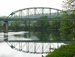
Hanging Rocks Wappocomo WV 2014 08 24 05

Wappocomo is an unincorporated community in Hampshire County in the U.S. state of West Virginia. The community is located south of Springfield on West Virginia Route 28 at Hanging Rocks along the South Branch Potomac River. Wappocomo has also historically been referred to as The Rocks, Wapocoma, and Wapocomo. The community's name comes from the Native Americans of the area, Wappocomo meaning South Branch Potomac River in the local Indian language.Wappocomo has become a popular location on the South Branch for summer campsites with both locals and out-of-state visitors. It should not be confused with the Wapocoma Campgrounds, located five miles south of Romney on South Branch River Road (West Virginia Secondary Route 8).

Excerpt from the Wikipedia article Wappocomo, West Virginia (License: CC BY-SA 3.0, Authors, Images).

Wappocomo, West Virginia
Cumberland Road,

Geographical coordinates (GPS) Address Nearby Places
placeShow on map

Wikipedia: Wappocomo, West VirginiaContinue reading on Wikipedia

Geographical coordinates (GPS)

Latitude Longitude
N 39.395 ° E -78.734722222222 °
placeShow on map

Address

Cumberland Road

Cumberland Road

West Virginia, United States
mapOpen on Google Maps

Hanging Rocks Wappocomo WV 2014 08 24 05
Share experience

Nearby Places

Valley View (Romney, West Virginia)

Valley View is a mid-19th-century Greek Revival residence and farm overlooking the South Branch Potomac River northwest of Romney, West Virginia. The house is atop a promontory where Depot Valley joins the South Branch Potomac River valley. The Valley View property was part of the South Branch Survey of the Northern Neck Proprietary, a large tract that was inherited by Thomas Fairfax, 6th Lord Fairfax of Cameron, in 1719. It was settled by John Collins and his family in 1749, and acquired by the Parsons family before 1772. The Valley View house was built by James Parsons Jr. in 1855. After the Civil War, Parsons' widow sold the farm to Charles Harmison. His wife, Elizabeth Harmison, inspired by her childhood Virginia home, Western View, and the scenic South Branch Potomac River views, named the farm Valley View. The most recent of a series of owners, the Mayhew family, bought the property in 1979. Valley View's current proprietors, Robert and Kim Mayhew, have restored the historic residence and grounds. The house at Valley View is a two-story brick structure with a rectangular architectural plan. The front entrance is covered by a small portico, topped with a pediment supported by wooden Doric columns. The rear of the house, with a two-story wood porch stretching across it, faces the South Branch Potomac River valley and Mill Creek Mountain. Each of the original eight large rooms of the 1855 structure contains a fireplace framed by a wooden mantelpiece with classical elements. The original windows, wooden trim, and materials in the main section of the house are intact. The house was listed on the National Register of Historic Places in 2012 as a locally significant example of Greek Revival architecture.