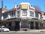
Strathfield South, New South Wales

Strathfield South is a suburb, in the Inner West of Sydney, Australia in the state of New South Wales, 13 kilometres west of the Sydney central business district, in the Strathfield local government area. The area was historically part of Druitt Town. Later it was part of Enfield, until Enfield Council was absorbed into Strathfield and Burwood councils, after which the part within Strathfield council was renamed Strathfield South. North Strathfield and Strathfield are separate suburbs, to the north. Strathfield South is located between Liverpool Road (Hume Highway) and the Cooks River, bordered on the east by Coronation Parade and to the west by the Enfield Marshalling Yards.
Excerpt from the Wikipedia article Strathfield South, New South Wales (License: CC BY-SA 3.0, Authors, Images).Strathfield South, New South Wales
High Street, Sydney Strathfield
Geographical coordinates (GPS) Address Nearby Places Show on map
Geographical coordinates (GPS)
| Latitude | Longitude |
|---|---|
| N -33.8894 ° | E 151.0831 ° |
Address
High Street
High Street
2135 Sydney, Strathfield
New South Wales, Australia
Open on Google Maps


