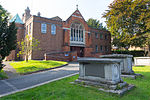
Woodford Wells
Areas of LondonDistricts of the London Borough of RedbridgeLondon stubsUse British English from September 2015
Woodford Wells is a small settlement on the edge of Epping Forest, in Woodford, East London. The area lies about 9.5 miles (15.3 km) north-east of Charing Cross. The name is shown in the Chapman and Andre 1777 map of Essex, and shortly after on an Ordnance Survey map of 1805; the name refers refers to mineral water wells. In the 18th century briefly the hamlet was a small spa but by the 1870s the wells had been long neglected and Woodford Wells had become part of a "straggle of hamlets". Among its notable features is the Horse & Well, a 17th-century coaching inn still in operation. Woodford Wells is home to Woodford Wells F.C.
Excerpt from the Wikipedia article Woodford Wells (License: CC BY-SA 3.0, Authors).Woodford Wells
Belmont Close, London Woodford Wells (London Borough of Redbridge)
Geographical coordinates (GPS) Address Nearby Places Show on map
Geographical coordinates (GPS)
| Latitude | Longitude |
|---|---|
| N 51.615645 ° | E 0.028861 ° |
Address
Belmont Close
IG8 0NX London, Woodford Wells (London Borough of Redbridge)
England, United Kingdom
Open on Google Maps


